DAY 20: Monday May 20th 2024 TOZEUR AND SURROUNDS, TUNISIA

Our Ras Ain Hotel had four bus-loads of guests staying last night and we were fearful that breakfast this morning would be a super bun-fight as was dinner last night. However, luck was with us and at 07:15 there were only four guests in the breakfast dining area.

At 08:30 we met Ridah our 4x4 driver for the morning’s session to visit various locations around Tozeur.     

We went about 50 km northwest from Tozeur and made our first stop at the Berber town of Chebika which is not far from the border wth Algeria. Chebika is one of the best known Tunisian mountain oases and until the 19th century was a major caravanserai for traders coming from central Africa to the Mediterranean coast. During Roman times it was used as a military fort where legionnaires had high sentry posts located on the Atlas Mountains that are just behind Chebika.

Chebika

Original village, Chebika

This oasis occurs because there are bountiful springs that provide fresh water for human usage and for the growing of date palms. Dates seem to be the main produce although other fruits and vegetables were apparent too.

Firstly, we climbed up a fairly steep pathway to a high point which gave us a panoramic view over the town and its oasis.

Chebika Oasis

Chebika Oasis and village

Mountain above Chebika Oasis

Then on descending via a different path we reached the point where the crystal clear spring water appears out of crevices at the base of the mountain.

View of the spring from the mountain

We then followed this small stream back to the township and on the way took photos of where the stream cascades over a small waterfall. The concept of a waterfall in the Sahara was a cause for contemplation.

Spring, Chebika Oasis

Stream in gorge, Chebika Oasis

Chebika has developed a nearby phosphate mine and together with the onset of mass tourism, customs and traditions have changed in recent times and are a concern for locals.

We then drove a little further northwest to the next oasis of Taemaghzah. 

Taemaghzah

Taemaghzah is known as the ‘hanging balcony overlooking the Sahara Desert’.

On arrival we chatted with a local man who showed us both male and female date palm plants and pointed out the differences in the palm leaves (fronds).

At Taemaghzah we descended to the oasis valley and once again encountered a waterfall of around 10 m drop although the water flow was not great. Further walking down the stream led us to a branch and we entered the Taemaghzah Canyon. This narrow and high canyon featured in one of the Indiana Jones’ movies. It was somewhat reminiscent of the Siq canyon on entry to the Treasury at Petra.

Gorge, Taemaghzah

Canyon, Taemaghzah

The town of Taemaghzah replaces the old town that was destroyed by flood waters in 1969. The old village was visible from a high viewing point and appears to be mostly ruins.

Old town of Taemaghzah

On leaving Taemaghzah we headed south and then left the main road and went onto a rough and sandy Saharan track. We drove for about 30 km in 40°C temperature with dust and sand making visibility of the track an issue. In several sections we climbed steep dunes and enjoyed the ‘free fall’ descent on the other side. This road(?) was part of the Paris to Dakar rally track in past times before it moved to Saudi Arabia. One prominent and high rocky area we passed featured in the movie ‘The English Patient’.

Area where part of the movie The English Patient was filmed

Our driver Ridah and Land Cruiser in the area where part of The English Patient was filmed

In the middle of nowhere we then came across a semi-abandoned film set used by George Lucas in the production of one of the Star Wars movies. It is now a tourist centre offering camel rides, minerals, fossils and the usual bits and pieces.

Area where part of Star Wars movie was filmed

Robots used in the first Star Wars movie

We were intrigued to see the Star Wars’ buildings, homes, robots and other remaining movie fragments many of which were made from plywood, canvas and plaster of Paris.

We then returned to Tozeur but before doing so we made a brief stop at Corneille where the panoramic view over the township was sadly affected by the dusty atmosphere.

Panoramic view over Corbeille through sand storm

We had a relaxing afternoon with free time until 18:00 when activities recommenced.

Our driver dropped us off at the entrance to the Tozeur Medina and we then spent the next hour or so wandering around the alleyways observing Tunisian night life and especially the 14th century high building walls made of distinctive handmade, yellow clay bricks. Apparently, 600 years ago there was a directive to all Tozeur home owners that they must incorporate at least a façade of the yellow bricks on all of their properties.

We then moved on to visit the private museum Dar Cherait which is devoted to Tunisia’s history with vivid displays of animal and human activities over the countless millenia. The section we visited transports visitors, with a loud English commentary through the history of Tunisia from the time of the dinosaurs and early humans to the Berber and Roman periods, the Muslim occupation and then chronologically through to more modern aspects of Tunisian life. The visual displays and the explanations offered were very well done and the visit proved most informative.

Exhibition inside Dar Cherait Museum of the Arts, Tozeur

Out evening finished with a special traditional Tunisian meal served to us in the Tozeur oasis where we were the only guests. Our delectable meal was enjoyed under date palms with a waxing moon above. The lamb main course was superb and supplemented by a tasty rosé.

Corinne, Diana, Chris and Jak at dInner table in oasis, Tozeur

We were back at our hotel by ten and preparing for another busy day tomorrow when we visit Douz and Matmata.

DAY 21: Tuesday May 21st 2024 TOZEUR - MATMATA, TUNISIA

Our post-breakfast morning was spent in Tozeur with our first activity being an hour’s horse drawn carriage ride through the town’s central oasis. The carriage was four wheeled and dainty and our driver was a large jovial fellow who obviously adored his horse ‘Julie’. At one point when stationary the driver gave Julie some dates to eat which she clearly relished and when she’d finished this treat she then spat out the pits!

Our horses & carriages, Oasis of Tozeur

The oasis area contains many hundreds of date palms and other fruiting plants such as pomegranates, lemons, figs, berries and pears. The oasis is supplied with water flowing along concrete water channels that form a pattern to maximise the irrigation but to minimise water wastage.

Samir explained to us how the pollination of the dates palms is achieved where male pollen frond sections are taken up the female trees by a climber who then transfers the pollen to the female flowers.

A local personality Mr. Mohammed then demonstrated the skill and strength needed to climb these tall palms. He quickly scaled a 10 m palm using hands and bare feet with no ropes or safety harness! The OH&S issues obviously don’t rate a mention in Tunisia!

Male & female date palms, Oasis of Tozeur

Mohammed climbing date palm, Oasis of Tozeur

Mohammed climbing date palm, Oasis of Tozeur

We then departed Tozeur driving southeast towards Douz. The road we travelled on for about 60 kilometres passed through the vast and glittering Chott El Jerid which is Tunisia’s largest salt lake. The lake was created by tectonic movements of the Earth’s crust some 1.5 million years ago and its area is just over 51 thousand square kilometres.

Half way along the salt lake causeway we stopped and walked down to the (mostly) dry lake’s surface to see the evaporation ponds where crystalline salt is being formed. The billiard table flat salt lake extends to a mirage with the horizon appearing as if there’s water.

Chott El Jerid (Tunisia's largest salt lake)

These salt flats are sometimes used for competitive ‘land-yacht’ racing. The so-called ‘deluxe’ toilet block at this stopping point was a cause for much amusement. Other less flattering descriptions would have been more accurate.

'Titanic', Chott El Jerid

Toilets, Chott El Jerid

A very interesting site was visited next near the township of Suq al Ahad. A bore has been drilled 2.8 km down into the Earth to reach a region where there is estimated to be a vast supply of fresh water. The extraordinary thing about this high purity water now being pumped to the surface is that the temperature is about 85°C. The water is then allowed to fall through chambers in a large building causing some evaporative cooling and bringing the temperature down to about 70°C. It then undergoes further cooling by passing through a maze of concrete channels arranged in a pyramid form. The now cooler water is then directed in irrigation lines to farms and homes.

Water cooling tower, Suq al Ahad

Pump for Water cooling tower, Suq al Ahad

We stopped for rest, relaxation and drinks at Douz, right on the edge of the Sahara. Camel rides and quad-cycle hire seem to be ‘all the go’ in this tourist town but with the air temperature in the high thirties we found a shady spot and enjoyed some coffees, crepes and cold orange juice.

Camels, Douz

Diana, Jak, Corinne & Chris, Douz

Our driver Arbi & guide Samir with ice & fresh oranges

Freshly squeezed orange juice with ice in the middle of the desert!

An 85 km journey eastwards from Douz through a largely barren desert landscape brought us eventually to the Berber village of Matmata. A little before arriving at Matmata we spent some time visiting a small troglodyte housing area just off the main road.

The troglodyte homes have been dug out of the sandstone rock to create thermally insulated rooms that escape the intense daytime heat. This building tradition which allows the rooms to maintain an even temperature of about 17°C all year round goes back hundreds of years. We were able to look inside the various rooms and to gain some insight to the troglodyte lifestyle.

Troglodyte homes, Tomazret

In the late afternoon we arrived at the night’s accommodation, the Diar Matamata Hotel. Our hotel room is in the form of a hemispherical cave hewn from the sandstone rock hillside. The room is about 12 m x 3 m and the ceiling height varies between 1.5 and 2.0 m. The curved walls are painted white and there are two small recessed areas off to the side of our tunnel for storage or extra beds. Like other troglodyte homes, our room has a very comfortable temperature, significantly less than the Saharan heat experienced earlier today.

Courtyard at Diab Matmata hote, Matmata

Our room at Diab Matmata hote, Matmata

In the cool of the late afternoon we drove 10 km back towards Douz and visited the village of Tamazrat.

Evening light, Matmata

Diana & our driver Arbi with our van, Matmata

The cave dwellings here are Berber homes and the remarkable thing about these troglodyte dwellings is the tunnelling that has occurred. Many of the cave homes have other homes above and below them and the caves have interconnecting tunnels between them. These tunnels then link to a larger 3.5 km long tunnel that leads down to a communal spring providing a domestic water supply. We were informed that the large, long tunnel is sufficiently big that even a camel can walk through it!

Tamazrat Village

Tamazrat Village

Opening to tunnel, Tamazrat Village

We spent an hour at the private Berber museum of Monji who provided us with a most informative guided tour. The Berbers or Amazigh people of this area have lived in these cave dwellings for four hundred years or more and have developed a unique social culture together with their different clothing, jewellery and family lifestyle. Monji explained how marriages are arranged between families and that daughters choose a husband after having interviewed appropriate options. Another interesting cultural point of interest was that women who have been divorced several times have high esteem and earn respect for their strength of character.

Monji (owner) demostrating the Berber Yaz symbol for a free person, Berber Museum, Tamazrat Village

Berber Museum, Tamazrat Village

The problem of having limited or no chimneys in the caves to release smoke from cooking using wood fires has led to kitchens typically having black ceilings.

Kitchen with black ceiling & chimney, Berber Museum, Tamazrat Village

Monji showed us the access point to the tunnel under his home but said that it is no longer used and now an ‘out of bounds’ area.

Tamazrat Village

We returned to our Diar Matamata hotel and had an enjoyable buffet style evening meal and then undertook diary writing and photograph downloading tasks in our very different and interesting troglodyte home.

Tomorrow we spend time in and around Matmata and then head east to the island of Djerba.

DAY 22: Wednesday May 22nd 2024 MATMATA - DJERBA, TUNISIA

We started the morning with a short visit to a troglodyte home in Matmata that has been partially converted into an hotel and also a tourist site. The cave houses in this location have special significance because George Lucas, the creator of ‘Star Wars’ decided that they would be ideal sites in which to film some scenes from the movie.  

The location has been made a bit too touristy now but there are sufficient remnants of props from the movie and the physical surrounds to bring back distant memories. The ‘bar’ scene from the first Star Wars movie was filmed right here.

Star Wars Hotel where bar scene for Star Wars No 1 was filmed, Matmata

Bar at Star Wars Hotel where bar scene for Star Wars No 1 was filmed, Matmata

On the road to Medenine we stopped at a high viewing point to look down on the small ancient town of Toujan at which we then later stopped. This half deserted village lies below the ruins of a kasbah (fortress). It has flat roofs of olive wood and walls made with brown cemented stones. The village is terraced on the side of a quite steep hillside.

Toujan from viewing point on hill above

Olive grove, Toujan

Terraced farmland, Toujan

Jak suggesting where the problem is with the door which wouldn’t open despite efforts with a hammer and trowel! Toujan

Toujan

Goats inside house compound, Toujan

We then continued and made a stop at Tozeur. This ancient town is centred on a beautiful oasis and with its four thousand palm trees has the reputation for growing the best dates in Tunisia.

A short distance from Tatauoine is the small two thousand year old village of  Ksar Haddada (Hedada) with its superbly restored ksar (fortress granary) near the village centre.

George Lucas used this place as a location for the Star Wars prequel, ‘The Phantom Menace’.

Ksar Hedada (Granary), Used to film Star Wars - The Phantom Menace (shot in 1997)

Hotel Ksar Hedada,

At Hedada we explored the maze of stairways, terraces and courtyards and peered into many granary niches known as ghorfas. In one ghorfa we found an ancient olive press involving a large conical stone revolving on a flat stone top.

Ancient olive press, Ksar Hedada

Diana, Chris, Jak and Corinne, Ksar Hedada

We next made brief stop at the nearby location of Taquet Hamed. This site has small but distinct images of animals drawn in red coloured rock on the underside of a sandstone cliff ledge. The prehistoric images are estimated to be about 20,000 years old and depict a horse and a bull.

Rock paintings at Taquet Hamned, near Ksar Hedada

Cave with Rock paintings at Taquet Hamned, near Ksar Hedada

The scenery in this southern Tunisian area is quite stark and barren with brown rocky plains leading across to jagged clay coloured mountains. The geology is fascinating with some layers of rock having been eroded differently forming natural terraces and eroded mountain tops, leaving only flat peaks and mesas.

Hills near Ksar Hedada,

Village of Germassa

Mosque, Village of Germassa

Village of Germassa

With Tataouine as our central base we then visited a number of nearby ancient historical sites including Germassa and Chenini. We were informed that Tataouine provided the name for Luke Skywalker’s mythical and wind-blown home planet of Tatoone.

Chenini is a 2000 year old Berber village which occupies a scenic position on a high mountainside with panoramic views out over the dry, rocky plains of southern Tunisia. The comparatively steep 300 m climb to our lookout point was well worthwhile despite the 32°C conditions we faced.   

Chenini Village,

Chenini Village,

Chenini Village,

We stopped for a lunch break at Douiret and to earn our repast we had another climb up a steep pathway for about 200 m. The meal was tomato soup, vegetable pasties, green salad, goat meat and couscous and finally fresh fruit. It was a most enjoyable break.

View from restaurant, Douiret

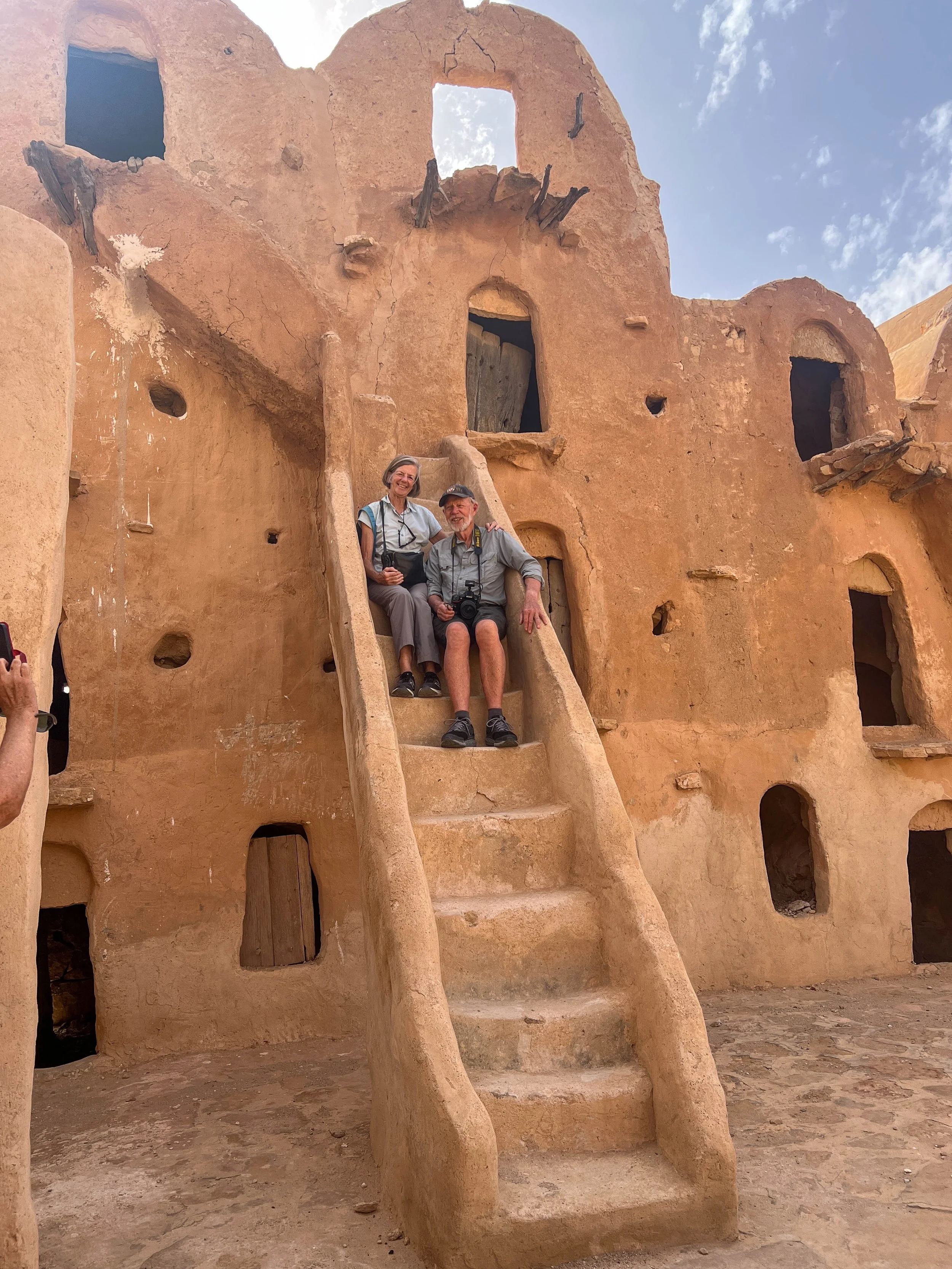
Then the highlight of the day was to occur when we visited Ksar Ouled Soltane which is 20 km south of Tataouine. This the best preserved and most interesting fortified village in Tunisia. It is still used to store grain and olives and is inhabited by Ouled Chehida tribesmen. The site is surrounded by defensive walls and consists of over 300 granaries (ghorfas). The ghorfas rise to four storeys and are set around two courtyards linked by a narrow corridor made from palm wood. The stairs leading to the higher levels are steep with no handrails and some have turns making for precarious ascent and especially descent.  The oldest section dates from the 15th century and is in truly remarkable condition. We found this encounter to be one of the very special highlights of our travel adventure so far!

Corinne and Jak, Ksar Ouled Soltane

Ksar Ouled Soltane

Ksar Ouled Soltane

Ksar Ouled Soltane

The remainder of our travel for the day was now the two hours heading northwards towards Ajim and then across the Roman built causeway to the island of Djerba.

View from Roman built causeway to the island of Djerba,

Our next two nights will be here on Djerba island staying in the rustic Dar Dhiafa hotel.

DAY 23: Thursday May 23rd 2024 DJERBA ISLAND, TUNISIA

The small island of Djerba lies at the southern end of the Gulf of Gabes approximately five kilometres from the mainland. It has an area of about 500 square kilometres and would be a semi-desert island apart from the determination of Djerba people over the years who have developed 4000 wells. This low-lying island (maximum altitude 38 m) is now a big olive grove, a fruit orchard and a popular holiday location with the main tourist zone on the northern coast supplied with water by an aqueduct.

After breakfast our guide Samir led us on a walking tour in the medina district immediately around our hotel.

The architecture comprises mostly two storey homes with whitewashed surrounding walls. As an initiative to bring tourists to this part of Djerba, the local community elected in the early 2020s to make the village into a ‘street-art’ centre and invited prominent Tunisian artists to display their work.

The wall art we observed was amazing with many hundreds of large images, mostly in colour and having a very broad range of themes.

Street art, Djerba Island

There were strong visual messages of people calling for peace and beautiful paintings of local animals such as the fennec (desert fox) and flamingos.

Octopus street art

Flamingos street art

Fennec (Desert fox) street art

Peugeot 404 utility street art

Still-life scenes and portraits of prominent people were common as well.

Street art

Street art of cyber dissident Lina Ben Mhenni

Some of the art work was showing the effects of time but most was in an extraordinarily good condition. It was pleasing to note that there was no sign of graffiti or attempts to interfere with the artists’ work. The stroll we had around these streets and alleyways was most enjoyable.

We then drove to the El-Ghriba which is Tunisia’s most famous synagogue. The El-Ghriba is about 400 years old and was built on the site of the original synagogue dating back to the fall of Jerusalem in 586 BC. It is an important place of pilgrimage for North African Jews especially during the Passover Festival.

Inside Synagogue El-Ghriba

Although relationships between Muslims and Jews are generally good on Djerba, there was a terrorist attack in 2002 which killed 21 people and damaged part of the synagogue’s interior. Before entering the synagogue we had to pass through a security screening check where there were ‘rapid-response’ police officers with very serious looking guns!

The synagogue’s prayer hall’s twelve windows allude to the Zohar and symbolise the twelve tribes of Israel. The interior is decorated with rich fabrics, wood carvings, chandeliers and ceramic tiles. The Torah is stored in an elaborate wooden cabinet together with numerous religious scrolls.

Sabbath services take place each Saturday but the services are short since the majority of Djerba’s one thousand Jews traditionally have their main sabbath celebrations at home.

Next to the synagogue is a large building which serves as a meeting place and accommodation for visiting Jews. The expansive courtyard is surrounded by two storeys of arched colonnades.

Caravanserai on right hand side of Synagogue El-Ghriba

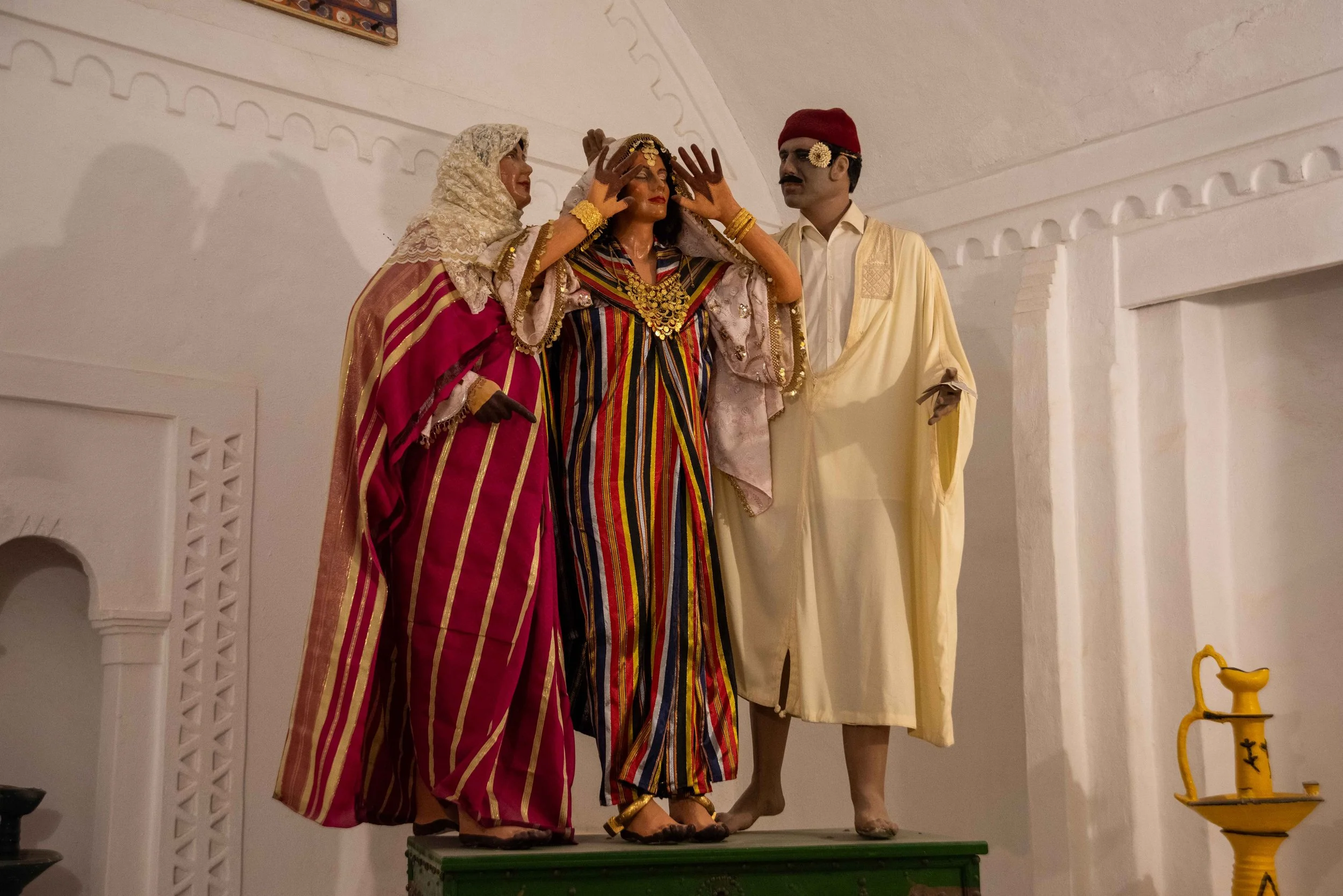
Our next stop was at the Guellala Museum with exhibits of traditional Tunisian life. The displays are colourful and use waxwork tableaux to conjure up the activities and facets of Tunisian life over the last thousand years or more.

View from Musee de Guellala

Musee de Guellala

There was a major emphasis on the rituals associated with Tunisian marriages, with a number of scenes showing the bride’s seven says of beauty preparation and decoration of her clothing with jewellery.

The fifth and last day of the wedding when the festivities are coming to an end, the bride shows her face uncovered for the first time, the Rite of Jiloua

Rite of traditional circumcision, Musee de Guellala

Other scenes showed traditional bread making, pharmacist/herbalists, fishermen, fortune-tellers, olive oil extraction and a number of others. The most intriguing tableau involved dancing men from the Issaouis sect undergoing trances due to the sustained and loud, rhythmic tribal music. A state of semi-anaesthesia is induced in the dancers who were shown to be undertaking extraordinary acts of self-punishment. One dancer was pressing cactus thorns against his naked chest, another was swallowing live scorpions and a third dancer was pushing an iron nail into his throat! Strange indeed.

The Issaouis, Musee de Guellala

Eating a live scorpion, The Issaouis, Musee de Guellala

The distance we had walked around the extensive museum site was great so cold drinks were necessary before we moved on.

Courtyard, Musee de Guellala

Olive press, Musee de Guellala

A pleasant hour or so was next spent at a large pottery factory in Guellala. Guellala has been the main centre for the production of pottery and ceramics for centuries. This prominence of pottery in this region is due to the availability around Guellala of the very best type of clay needed by potters.

The factory we visited had an outside yard that was jam-packed with thousands of large jars and pots and inside the display and shop area the range of items was phenomenal.

Pottery at Guellala - outside

Pottery at Guellala - intside

We watched a potter with great artistic skill produce a vase, a saucer and teacup using a foot turned potter’s wheel. We were then shown the ancient underground kiln that was used before the days of gas firing. We bought a small and colourful ceramic jar.

Potter at Guellala

Potter making cup at Guellala

We then spent some time in Houmt Souk which is the main city on Djerba. It’s a tourist centre full of shops selling jewellery, clothes and souvenirs.

Of particular interest are the city’s fondouks which are a type of caravanserai built as inns for travelling merchants during the Ottoman period. Unlike caravanserais, the provisions and spaces for stabling donkeys, camels and other animals in fondouks are missing.

We returned to our hotel in mid afternoon and were appreciative of some free time to catch up on tasks and relax as most days this last week have been so busy and full-on with activities and sight seeing.

G&Ts by pool at our accommodation at Hotel El-Riadh

Dinner at Hotel El-Riadh

Our evening dinner at the Dar Dhiafa hotel was a vegetable soup, a delectably grilled local fish and finally profiteroles washed down with a local, good quality dry white wine; a magic end to the day!

DAY 24: Friday May 24th 2024 DJERBA ISLAND - SOUSSE, TUNISIA

Instead of retracing our steps and using the Roman causeway to leave Djerba, we drove to the ferry terminal at Ajim on the southeastern corner of Djerba and caught the ferry. This shortened route to our destination of Sousse will save about one hour’s road travel today.

This large vehicle ferry when fully loaded with buses, trucks, cars and motor bikes left the dock and headed across to the nearby mainland port of Jorf, a trip that took about half an hour.

Our van on the ferry from Ajim on the southeastern corner of Djerba to Jorf on the mainland

Leaving Ajim, Djerba

Fishing boat between Ajim and Jorf

Approaching Jorf on the mainland

Once at Jorf, we joined the P1 highway and started our journey north towards Gabes, with our first stop being at Mareth.

Mareth was a significant battle site during the Second World War and there is now a military museum located there.

The Mareth Defensive Line Museum relates to the Battle of Mareth in Tunisia where the British Eighth Army led by General Bernard Montgomery attacked the Mareth Line held by the Italy-German First Army led by Giovanni Messe. With reinforcements, Montgomery undertook a ‘flanking attack’ and on the 31st March 1943 the Germans were forced to retreat in what was to be the start of their eventual defeat in North Africa.

At the museum we initially watched a short documentary on the Battle of the Mareth Line and then looked at mostly WW 2 military equipment such as Rommel’s Volkswagen, British motorbikes and an extensive range of armoury including machine guns, rifles, pistols and canon. We also went inside one of the underground bunkers which were part of original Mareth Line fortifications built by France in the late 1930s during their war against Italy who occupied Libya at that time.

Rommel's Volkswagon, Mareth Defence Line Museum, Mareth

Bunker, Mareth Defence Line Museum, Mareth

German heavy cannon type 15-Schwere Feldhaubitze 18 weapon, Mareth Defence Line Museum, Mareth

After two hours of travelling north on the P1 highway through an uninspiring desert landscape we reached the El-Jem Amphitheatre in the former Punic town of Thysdrus. After the Third Punic War, Thysdrus declared itself to be on the side of Rome and was awarded the status of being a free town. In the mid 3rd century AD El-Jem became a Roman colony and was amongst the richest towns in Roman Africa.

Chris, Corinne, Jak and Diana, El-Jem Amphitheatre, Thysdrus

The most significant and historic relic of El-Jem is the amphitheatre. Built between 230 and 238 AD this absolutely magnificent structure, modelled on Rome’s Colosseum is the third largest Roman amphitheatre and the best-preserved Roman relic to be found in Africa.

The 36 m high structure is elliptical in shape being 148 m x 122 m and had a seating capacity of approximately 30 000.

El-Jem Amphitheatre, Thysdrus

El-Jem Amphitheatre, Thysdrus

El-Jem Amphitheatre, Thysdrus

El-Jem Amphitheatre, Thysdrus

We spent an hour wandering along corridors, up stairways and in amongst elaborate systems of pillars and arches. The radiating walls built from large sandstone blocks bear the vaults that support the tiers of seats, stairs and galleries.

El-Jem Amphitheatre, Thysdrus

El-Jem Amphitheatre, Thysdrus

The grandiose façade is composed of three storeys of 64 arcades each with the semicircular arches adorned with imbedded Corinthian columns.

Underneath the central arena we found numerous rooms and were informed that these were for housing the gladiators, prisoners and wild animals such as lions and tigers all of whom played some part in the often gruesome events to entertain the masses.

The visit to this architectural marvel of El-Jem has undoubtedly to be an occasion that will be etched into our memories for many years to come.

After El-Jem we visited the town’s Archeological Museum which is housed in one of Tunisia’s best-preserved Roman villas called the House of the Peacock and Solertiana.

The main exhibits were Roman mosaics, sculptures and ceramics.

Courtyard, House of the Peacock and Solertiana

Mosaic representing the triumph of Bacchus, House of the Peacock and Solertiana, Thysdrus

Inside the House of the Peacock and Solertiana, Thysdrus

The mosaics were particularly impressive and in most cases they were obtained from excavations carried out in the section of the city where ancient Thysdrus once existed.

Dovecote, House of the Peacock and Solertiana, Thysdrus

We then completed our day by driving through much richer farming area where there were olive trees extending on both sides of the road as far as the eye could see. Our destination was Sousse and the Movenpick Hotel where we said farewell to Samir who has been our wonderful guide for these past twelve days.

View from our Movenpick Hotel room, Sousse

Tomorrow, we move on to Algeria and begin a new phase of this amazing North African adventure.

DAY 25: Saturday May 25th 2024 SOUSSE - TUNIS - ALGIERS, TUNISIA - ALGERIA

Our hotel in Sousse was about 130 km from the airport in Tunis (Carthage International Airport) so we decided to make an early start to be assured of arriving at the airport with plenty of time for our 11:30 boarding time.

We checked out at 07:30 and Arbi, our superb driver for the past twelve days was waiting as always to load bags and take north to Tunis. Much of our travel was on the expressway at 110 km/h but things slowed considerably as we approached the outskirts of Tunis where the traffic density was horrific.

We arrived at the Carthage International at 10:15 and were through check-in, customs and security in relatively quick time and had only an hour or so to wait before boarding began.

Departing Tunisia

The flight time to Algiers was about eighty minutes and much of the flight path followed the North African coastline. It was interesting to note that Tunisia seems much drier than Algeria. From Tunis to Annaba the farmland appeared yellow with drought effects apparent  but from Annaba onwards there seemed to be a more fertile verdant landscape with appreciable areas of green crops and orchards.

Arriving in Algeria

On landing at Algiers airport and whilst still taxiing we were amused to see that the majority of the passengers stood up to collect things from the overhead lockers. This was happening well before we had come to a final stop at the terminal. These passengers were reprimanded and told that the plane would not finally dock at the airbridge until they’d all been seated again!

We filled in ‘arrival cards’ and then waited in a queue for about and hour to go through customs. The female custom’s officer dealing with our queue did not seem very friendly towards most passengers but when she found that we were tourists spending a fortnight in her country, she became quite animated.

Rabiha, our contact person with ‘Native Eye’ was waiting outside the terminal for us and we attempted to make pleasantries in French as she led us to the van and its driver.

The drive from the airport to our Hotel du Val was in very heavy traffic and our driver negotiated the final narrow streets to our hotel with admirable skill.

We went to an ATM to get some local currency which is the dinar (DZD), as in Tunisia but here in Algeria, AUD $1 = DZD 89 whereas in Tunisia, AUD 1$ = 2 TND.

We have a very comfortable room on the third floor of the Hotel du Val which is in a district with a number of restaurants and cafés close by.

View from our hotel room of playground at 7-00pm, Algiers

We have much of the afternoon to relax, write diaries and get some washing done before commencing our exploration of Algiers tomorrow.

DAY 26: Sunday May 26th 2024 ALGIERS, ALGERIA

Algiers, the capital of Algeria is located on a series of hills overlooking the Mediterranean Sea and is regarded as one of the most attractive cities in North Africa.

It was founded by the Phoenicians in around 800 BC and later conquered by Rome in the second century BC. The Muslims took control in the 8th century AD.

During the 19th century it was a notorious haven for the pirates of Barbary, prompting intervention and the annexation of Algeria by the French as one of numerous examples of European colonial involvement in Africa.

Present day Algeria has independence having fought a violent war against France from 1954 until the March 1962. The population of Algeria is 45 million and that of Algiers is about four million.

Our first full day in Algeria commenced with meeting our guide Moncef and our driver Adlene. We then drove westwards from Algiers following close to the coastline for about 70 km passing through prosperous agricultural areas with fertile red soil. There were a large number of plastic covered ‘green-houses’ with tomatoes, pumpkins and capsicums being the principal crops grown under cover. Large areas of potatoes, grapes and climbing beans were common too as were the extensive areas of barley cropping.

Greenhouses along shores of the Mediterranean Sea, between Algiers & Tipasa,

Farmland viewed from Royal Mausoleum of Mauretania, Sidi Rached

We then made a stop at Sidi Rached to view the Royal Mausoleum of Mauretania.

Royal Mausoleum of Mauretania

This mausoleum, built on a hilltop in 3 BC is the tomb where the Numidian Berber King Juba II and Queen Cleopatra Selene II were allegedly buried. However, their human remains are no longer at the site as the burial chamber has in the distant past been repeatedly ransacked by looters looking for treasures. Our guide informed us that Queen Cleopatra Selene II was the daughter of Pharaoh Queen Cleopatra VII and Roman General Mark Antony and that she was sovereign of Mauretania Caesariensis. This was the part of North Africa stretching from Morocco to Libya controlled by Rome at the time and should not be confused with the present day African country of Mauritania which has different spelling!

The 36 m high mausoleum is circular with a diameter of about 60 m and built entirely from large sandstone blocks.  The top was originally hemispherical or pyramidal and had a white limestone covering like the Great Pyramids at Giza.

The structure is architecturally grand with 10 m high Corinthian topped columns every four metres around the perimeter. There are four vast doorways (no longer accessible) located at the four cardinal compass points. One of the doors has a large carved cross on it indicating the north facing door and has nothing of Christian significance.

North facing door, Royal Mausoleum of Mauretania, Sidi Rached

Column and entrance, Royal Mausoleum of Mauretania, Sidi Rached

Column and entrance, Royal Mausoleum of Mauretania, Sidi Rached

Scrolls on pillar, Royal Mausoleum of Mauretania, Sidi Rached

Engraving on stone showing cardinal points of Royal Mausoleum of Mauretania, Sidi Rached

This was a most unexpected and spectacular visual feast.

Corinne, Jak, Chris and Diana, Royal Mausoleum of Mauretania, Sidi Rached

We then moved on to the harbour township of Tipasa and visited the small archaeological museum where there were some impressive Roman mosaics and items recovered from the nearby Roman township.

Mosaic, Archeological Museum of Tipasa

Amongst the treasures we saw were fine crockery and glassware plus marble sculptures. Especially prominent were the sculpted head of the god Jupiter and a 5000 year old plaque representing the Punic god Tanit.

Sculpted head of the god Jupiter, Archeological Museum of Tipasa

Roman glass jar, Archeological Museum of Tipasa,

A large floor mosaic, now on the wall of the museum showed praying Christians facing execution by the Romans.

Mosaic, Archeological Museum of Tipasa

We then spent the next two hours on a walking tour visiting the archaeological site of Tipasa.

Tipasa was an ancient Punic trading post, conquered by Rome and turned into a strategic base for its control of Mauretania. It became a Christian site after the 4th century AD.

The architectural and archaeological vestiges of Tipasa are extensive and we started at the amphitheatre built in the 3rd century AD. We were able to see enclosures for gladiators to prepare for fighting and tunnels used to introduce wild animals like tigers into the arena.

Amphitheatre of Tipasa

Amphitheatre of Tipasa

Area where gladiators entered the arena, Amphitheatre of Tipasa

We then moved on to the New Temple given this name by archaeologists as it was built after the adjacent temple called the Anonymous Temple! The New Temple has a magnificently paved court with stairs and porticos and there are the remains of an apse.

New Temple, Tipasa

The Decumanus Maximus road passes between the two temples and is a major, paved highway going east – west whereas Cardo Maximus runs north – south descending towards the sea. There was a ‘triumphant arch’ at the intersection of these two Roman roads but it was destroyed as was some of the road’s paving after an earthquake and tsunami in the 7th century.

Crossroads of main city, Tipasa

Near one of the main gates we then came upon an elaborate circular platform that once housed the ‘Fountain of the Nymph’ where the fountain’s water pressure was achieved by ingenious hydrological procedures involving venturis. Aqueducts brought in water and even 2000 years ago most houses in the Roman town had a water supply as well as some basic form of wastewater/sewerage management.

Fountain of the Nymph, Tipasa

The next site we visited was ‘The Theatre’ where performances were held in front of semi-circular, forty five levels of tiered seating holding up to 3000 people. The plays were usually performed at night when people were tired and more easily persuaded by the themes of the plays which were often ones involving brainwashing the populace with Roman propaganda.

Theatre, Tipasa

One of the visual splendours of our walking tour was the Roman Catholic Church of Bishop Alexander built in the 3rd century. It has four elegant arches still standing and impressive mosaic floors with the building perched on a platform overlooking the Mediterranean.

Roman Catholic Church of Bishop Alexander

Roman Catholic Church of Bishop Alexander

View of coastline from Roman Catholic Church of Bishop Alexander

Our visit was completed with brief encounters with a Roman gymnasium, a dolium (large jars) grain store and the remains of a very luxurious home.

Dolium (jars for grain)

Villa de Frescoes

We walked back to the van via the coastline and then after some refreshments headed back home to Algiers.

We have had a most interesting and informative first day in Algeria and are so impressed with our guide Moncef who has a wonderful knowledge of the history but also gives us plenty of time to wander around individually photographing things and taking it all in.

DAY 27: Monday May 27th 2024 ALGIERS, ALGERIA

This was to be another warm to hot day in North Africa and our first tourist destination was to be the Algier’s Arts and Culture Centre. However, on arrival we found that the centre was closed for the day. Apparently, the President of Algeria was visiting the centre and so the general public was to be excluded.

For plan B, we drove to a high hillside peak overlooking the Mediterranean to see the Notre Dame Cathedral of Algiers.

The construction of this impressive church began in 1944 but not completed until 1956. It had its status elevated to that of cathedral in December 1962. The designers and engineer were apparently inspired by the gospel of St. John but we’re unsure how this fits in with the architecture.

Basilica of Notre Dame

Column and dome on Basilica of Notre Dame

The style is Byzantine as shown by the light blue and dark blue tiling on the upper walls. The entrance stairs lead to two large arched doorways with high circular towers extending above them. These towers resemble the minarets one would expect to see at a mosque except for the statue of Mary placed centrally between them.

The dominant external feature of this cathedral is the central twelve-sided tower. Each of the sides has an arched window with an elaborately carved top-piece.

The upper tower section is a glistening white hemisphere carrying a top crown with stars around its base. A high crucifix is the apex.

Basilica of Notre Dame

Dome on Basilica of Notre Dame

The bell tower looked particularly impressive and we were informed that this cathedral has a ‘twin’ of near identical design in Marseilles.

Bell Tower, Basilica of Notre Dame

Chapel Saint Joseph - 1856 (Original chapel), Basilica of Notre Dame

View of the Mediterranean and Stadium from Basilica of Notre Dame

We decided to not enter the cathedral as it would have required waiting for some time before it opened.

Much of the remainder of the day was spent in the Casbah (or Kasbah) of Algiers. This is the old part of the city which was previously walled as a fortress but much of the wall has gone or is not easily seen.

Casbah wall

During the times of the Ottomans, the Casbah walls enclosed mosques, palaces, military stations as well as homes some of which were grand and others quite meagre.

In the upper section of the casbah we visited the mosque of the Dey (governor). The Dey was privileged to have a private mosque for use only by him, his four wives and their children. We were not told if the concubines were entitled to use the mosque too! The prayer hall has hexagonal brown floor tiles and walls covered in combinations of blue, green and white tiles. The outer perimeter of the prayer hall has beautifully carved marble pillars most of which have spiralled upper sections representing the tresses of a woman’s hair.  

Diana, Chris, Corinne and Jak, Mosque du Dey, Casbah

Stones at centre of spiral pillars to detect any movement, Mosque du Dey, Casbah

Ceramic tiles (green are original), Mosque du Dey, Casbah

On the four sides of the prayer hall were four rooms for the Dey’s four wives and upstairs were the rooms for the concubines, with the most recently selected concubine being offered the best room.

In order to defend the casbah (fortress) the Ottoman Empire had to have a strong military presence and this necessitated gunpowder amongst other things. Within the upper section of the Casbah was a gunpowder factory.

Although the original circular building no longer exists, a modern structure has been built over the top of the former building’s relics.

The floor of the new building has glass sections so we could look down and see parts of the old gunpowder factory. There were large underground areas where gunpowder was stored.

Jak in restored area showing undergroud gunpowder storage, Casbah

Underground gunpowder storage, Casbah

Busy alleyway of restaurant area in the Casbah

Narrow alleyway in the Casbah

We then had a traditional lunchtime meal in a well-to-do family home. The meal started with a rich tomato and herbs soup, traditional bread and spring rolls. The main meal was chicken, noodles, turnip and salad.  

Restaurant where we had lunch in the Casbah

Restaurant, where we had lunch in the Casbah

Our meanderings then took us down towards the lower half of the Casbah. There is a wide road, built by the French that separates the upper from lower Casbah regions.

On our meanderings we spoke with a tailor who was sewing a dress and was pleased to see our interest in his skills. We also chatted with a young woman whose shop specialised in perfumes. A man who made leather items was keen to show us his trade and became animated when we said we were from Australia.

Corinne in sewing shop in the Casbah

Corinne with local lady from perfume shop in the Casbah

Leatherman in the Casbah

We then moved on to the Palais of Mustapha Pacha which is one of the most prestigious palaces in the casbah of Algiers.

The palace was built by the Ottoman dey Mustapha Pacha in 1799 and he ruled in Algiers from 1798 until 1805 when he was assassinated by the army of janissaries (elite infantry soldiers).

Palais Mustaph Pacha in the Casbah

The palace is a Moorish palace and now serves principally as a museum. It now has the title of the National Museum of Miniatures, Illumination and Calligraphy. We found many of the exhibits to be incredibly old, interesting and extremely well curated.

Following on from the Pacha’s Palace we passed the 1436 Royal Mosque.

The Royal Family Mosque

We then moved down to the National Museum of Antiquities and Islamic Art. The range, age and diversity of exhibits was super impressive.

There were interesting Roman era mosaics; one particularly impressive mosaic showed a doctor giving advice to a sick man.

Mosiac, National Museum of Antiquities and Islamic Arts

A 3000 BC stone sculpture showed a face that appeared to be that of a diver using a snorkel but we’re sure our imagination was running wild.

Man wearing mask carving, National Museum of Antiquities and Islamic Arts

Man wearing mask carving, National Museum of Antiquities and Islamic Arts

The marble sculptures on display, and there were many, mostly came from excavations and recovery from ruins in and around Cherchell which is near Tipasa which we visited yesterday. Statues of Demeter (the goddess of agriculture), Bacchus (the god of wine) and Minerva (goddess of war) were especially ones that caught our eye.

Bacchus (the god of wine), National Museum of Antiquities and Islamic Arts,

Bronze Bacchus, Museum of Islamic Art

The section of the museum covering Islamic Art was not as interesting but that may have been due to us getting weary in the warm to hot afternoon weather. One Islamic item that was of interest was an Imam’s prayer dais dated at 1096. For timbers that are 1100 years old it was in remarkable condition.

Imam’s prayer dais dated at 1096, Museum of Islamic Art

On the final walk to find our van we saw a Christian church that look more like a condensation tower for a nuclear power station. It was the Sacred Heart Cathedral built in 1956.

'Nuclear' church

We returned to our hotel through incredibly dense traffic and then had to say farewell to our super guide Moncef as we have new guide for the remainder of our Algerian visit.

Tomorrow, we head eastwards towards Tunisia and will end the day at Constantine.

DAY 28: Tuesday May 28th 2024 ALGIERS – CONSTANTINE, ALGERIA

Our guide for the next ten days will be Ridwane and he speaks excellent English and is obviously someone who has been involved as a guide for quite some time. We departed Algiers at 08:00 and faced a 350 km drive to Djemila but to give the driver and us a rest, we took a drinks break at Bouira.

For a fair proportion of this drive along the main eastern freeway we were travelling through extensive grain growing areas with most barley crops already harvested and the wheat crops almost ready. There has been good rainfall this year and the grain yield is likely to be near record levels.

It seems unexpected that in the middle of farming land there will suddenly be a housing development. These new communities are typically made up of twenty or so eight storey high rise buildings surrounded by wheat fields.

At El Eulma we left the main expressway and drove about forty kilometres to the ruins of the Roman town at Djemila.

Djemila, (meaning beautiful) was formerly called Cuicul and is a location where some of the best preserved Roman ruins in North Africa are to be found.

In 1982 Djemila became a UNESCO World Heritage Site.

In the first century AD under the name of Cuicul the city was built 900 m above sea level as a Roman military garrison. It is situated in the province of Numidia on a narrow triangular plateau at the confluence of two rivers. The city was originally populated by a colony of Roman soldiers from Italy and then grew to become a major trading market centre. The prosperity of the city was principally due to the rich surrounding land producing cereals, olives and other farm produce.

Cuicul’s builders followed a standard plan with a forum at the intersection of two main streets, Cardo Maximus and Decumanus Maximus.

We commenced our visit to Cuicul at the museum. The township was renamed Djemila after the Muslims dominated the region in the post 7th century period.

The museum has the best collection of large mosaic tiled areas we’ve seen anywhere. The museum has six metre high mosaics around most of the walls that extend in a ‘U’ shape for about 50 m.

Mosaics & model of archeological site, Museum, Djemila

There are many marble statues and busts of prominent Romans and their gods including Hercules, Emperor Septimius and his Syrian wife Julia, Bacchus and Jupiter. The collection of other artefacts recovered from the Djemila site was most impressive and included pottery, glassware, surgical instruments, coins and carved ivory including a six-sided die.

Mosaics, Museum, Djemila

Our walking tour of the actual site took about three hours and we started in the upper Christian centre. Christianity spread through these lands in the 4th century AD after the collapse of the Roman Empire.

Archeological site, Djemila

Going down Cardo Maximus we passed a deep well and then came upon a fountain in the form of a phallus; it was supposedly the Roman’s symbol of fertility.

Deep well, Archeological site, Djemila

Fountain in form of a phallus, Archeological site, Djemila

The Triumphal Arch was originally going to be taken by the French but when an accident occurred and the idea of demolishing it and transporting it back to Paris proved too difficult, the French built their own Arc de Triomphe.

Triumphal Arch, Djemila

There were so many interesting sights to take in on this walking tour it’s hard to do justice to the amazing experience.

Our guide Ridwane on Cardo Maximus, Archeological site, Djemila

Amongst the first highlights we saw were the Temple of Venus and Market Square where a table for measuring out volumes of grain was ingenious.

Market Square and Temple of Venus, Djemila

Table for measuring out voumes of grain, Market Square and Temple of Venus, Djemila

We then moved on to the Temple of Jupiter and saw the remains of Jupiter’s enormous statue.

Jak standing beside statue of Jupiter, Djemila

Nearby was the main forum and this one could accommodate 6000 people and had massive, one metre diameter surrounding columns.

Sacrificial table in main forum, Archeological site, Djemila

We moved on down to the Theatre which due to the terrain, was built outside the town walls, which was quite exceptional. The acoustics in the theatre were superb with stage voices being quite clear at forty rows up the theatre seating.

Theatre, Archeological site, Djemila

We spent a good deal of time at the spectacular Temple of Septimius Severus who served as Emperor from 193 until 211 AD. The remains of the temple are in remarkably good condition and the sight is awesome.

Temple of Septimius Severus, Archeological site, Djemila

Capital of column, Temple of Septimius Severus, Archeological site, Djemila

Roman toilets in a nearby enclosure caused a degree of amusement as did the penis and testicles carved rock outside the brothel.

We finished with the Roman Baths and their four different temperature controlled zones; (hot, cold, sauna and solarium). The five large water reservoirs adjacent supplied water for the baths and the city. Water was collected from rainfall and brought in by aqueduct from mountain areas above the city. The population of the city was estimated to be around six thousand but then expanded to reach a maximum of fifteen thousand.

Roman Baths, Archeological site, Djemila

Roman Baths, Archeological site, Djemila

This visit has been a fabulous experience and differs in a significant number of ways from other ancient Roman sites we’ve been to in recent times.

We then drove another 125 km to Constantine where we are staying for two nights at the El Khayem hotel.

Tomorrow we will spend time visiting places of interest in and around Constantine.

DAY 29: Wednesday May 29th 2024 CONSTANTINE, ALGERIA

Our hotel is situated in the new part of Constantine which is about 10 km from the old city. The so-called ‘new’ city was built well outside Constantine’s original boundary in an attempt to reduce the level of population congestion occurring in Constantine.

Constantine, ‘the city of bridges’ is a dramatic city of precipitous cliffs and deep gorges, the lofty setting for one of Algeria’s most labyrinthine casbahs.

We entered the old city of Constantine and our first significant encounter with its historical past was the section of aqueduct constructed by the Romans in the 1st century AD. All that remains is about fifty metres of aqueduct including five arches of the supporting structure which is about ten metres high.

Section of aqueduct constructed by the Romans, Constantine

A little further along the road leading into Constantine, we stopped at the statue of Emperor Constantine I (or Constantine the Great) who was Roman Emperor from 306 – 307 AD. The statue is made from white marble and shows the emperor with his right hand lifted high and one assumes he’s offering strength and encouragement to his people. The site for the statue was chosen as it was here that in 1837 a battle commenced which saw the city of Constantine eventually fall and come under the control of the French.

Statue of Emperor Constantine I (or Constantine the Great)

Statue of Emperor Constantine I (or Constantine the Great)

Our next stop was the ‘Monument aux Morts’, a large stone arch set on a high cliff top offering sweeping views across the city.

Monument aux Morts, Constantine

The twenty one metre high arched monument was built in 1918 as a memorial to honour the Algerian soldiers killed in World War I. On the very top of the monument is a golden angel with wings held high as if in flight. The initial impression is that the angel is an eagle.

Golden angel on top of Monument aux Morts, Constantine

The view from this high cliff top is magnificent as there is a precipitous cliff edge leading down into a very deep gorge, formed by the Rhummel River.

View from Monument aux Morts, Constantine

We commenced a spectacular walk following the cliff edge and heading down towards the Sidi M’Cid Bridge. This is a 164 m long suspension bridge across the Rhummel River designed by French engineer Ferdinand Arnodin and it links the Casbah to Sidi M’Cid hill.

View of Sidi M’Cid Bridge from cliff edge, Constantine

The bridge was opened to traffic in 1912 and until 1929 it was the highest bridge in the world at 175 m above the Rhummel River gorge below.

We walked across this dizzying span and the views in every direction, especially downwards were breathtaking.

Jak walking across Sidi M’Cid Bridge from cliff edge, Constantine

Rhummel River gorge below Sidi M’Cid Bridge from cliff edge, Constantine

Rhummel River gorge below Sidi M’Cid Bridge, Constantine

Rock arch below Sidi M’Cid Bridge, Constantine

Having crossed the bridge, we were now in the old city casbah and surrounded firstly by souks selling fruit and vegetables and then clothing and kitchen items.

Marketplace in Old City, Constantine

Marketplace in Old City, Constantine

Amongst this network of alleyways we eventually turned a corner and found ourselves at the National Museum of National Arts, Expression and Culture. This building is the former Palace of Ahmed Bey, the last Ottoman governor of Constantine.

The Palace was commissioned in 1825 during the rule of Ahmed Bey (ben Mohamed Cherif) and completed in 1835. Ahmed’s enjoyment of this magnificent palace was short lived as he was forced to flee in 1837 when the French took control of the city.

Garden in National Museum of National Arts, Expression and Culture, Constantine

The palace had two gardens and numerous elegantly tiled rooms on two levels. The rooms were to accommodate his one wife, three children and his harem. The upper sections of the ground floor walls show paintings of the trip the Bey had taken when he travelled from Constantine to Mecca. His daughter, Princess Fatima had an upstairs room with peep-hole windows and colourful stained-glass windows.

Paintings of the Bey's trip from Constantine to Mecca, National Museum of National Arts, Expression and Culture

Our wandering through the Medina continued and we viewed the National Theatre (Opera), an impressive building with both classical and renaissance architectural styles.

National Theatre (Opera), Constantine

The National Museum Cirta was our next exposure to Algerian treasures. This museum has a fantastic collection of artefacts extending from Phoenician times at around 1000 years BC right through to the French occupation in the 1840s. The Roman influence during the first and second centuries gains most prominence in terms of the museum’s displays. The numerous marble statues on display were extraordinarily beautiful, especially Faustine, the wife of Emperor Antonin the Pius and the statue of Bacchus the God of Wine. Bacchus seems to crop up quite frequently! There were some very large and superb paintings on display too. One showed starving Constantine people suffering from deprivation following the French invasion in 1837.

Statue of Faustine, National Museum Cirta, Constantine

Statue of Bacchus, National Museum Cirta, Constantine

Painting showing starving Constantine people suffering from deprivation following the French invasion in 1837

There were hundreds of Phoenician grave headstones on display and one in particular celebrated the reign of King Massinissa from the 2nd century BC. Three Phoenician amphoras from that same period were most impressive too.

We had a brief stop at a side street community where craftsmen who specialised in the production of fine and high-quality copper and brassware were located.

Copper and brassware artisan's shop, Constantine

We then drove northwest from Constantine for 35 km to the remains of the Roman city of Tiddis which hovers on a barren mountain slope. The town dates back about 2500 years and was a native Berber town of the Numidia Kingdom prior to coming under Roman control.

Roman city of Tiddis

Roman city of Tiddis and surrounding countryside

We spent an hour viewing the remains that were not in particularly good condition. There are two, well preserved arches and the forum deserves a mention as it’s claimed to be the smallest Roman forum known to exist. Amongst things that caught our interest were the arched gate, the troglodyte caves, the carved sacrificial bulls, a wheat grinding mill and the 4th century baptistery. The Romans devised very clever hydrological methods for collecting and holding water using aqueducts and cisterns.

We returned to Constantine and photographed the new Sidi M’Cid Bridge built in 2016.

Sidi M’Cid Bridge, Constantine

We then moved to the famous Pont Sidi Rached where we spent time walking on the bridge. At 447 m length it is amongst the longest stone bridges in the world and was built in the period 1908 – 1912. The bridge bears the markings of both Roman and French architectural style. It rises to a height of 102 m above the Rhummel River and is composed of 27 arches, the largest of which has a span of 70 m. This bridge is unlike anything we’ve seen before; it is quite stunning and a remarkable engineering feat.

Pont Sidi Rached bridge, Constantine

The new Salah Bey Bridge, Constantine

To complete a very long day of activities we made a very quick stop at the Emir Abdelkader Mosque. This beautiful architectural masterpiece is visible from many parts of the city due to its enormous size and its extraordinarily tall minarets.

Emir Abdelkader Mosque, Constantine

We returned to our hotel at 18:40 and prepared for another busy day tomorrow with an early start when we move on and visit Biskra.

DAY 30: Thursday May 30th 2024 CONSTANTINE – BISKRA, ALGERIA

Our journey southwards today had us leaving Constantine at 08:00 and driving on the main highway towards Ain M’Lila and we were to have a police escort all day. We passed several large salt-flats where dehydration ponds were being used for the production of salt. At one of the larger salt-lakes called Sepkret Ez-Zemoul, we stopped and attempted to photograph the many hundreds of flamingos wading in the shallows presumably searching for crustaceans. The flamingos were too distant to get any shots of value.

Flamingos, Sepkret Ez-Zemoul

We then left the highway and followed a minor road until reaching our first main tourist site for the day at Medracen. Medracen (also spelled Medghassen) is a royal mausoleum-temple of the Berber Numidian Kings built in the fourth century BC or possibly even earlier, making it the oldest monument in Algeria. The archeological mystery is that nobody is quite sure for whom the temple was built although it’s assumed to be for King Medghassen.

Royal mausoleum-temple, Medracen

This circular mausoleum is 18.5 m high and 60 m in diameter and composed of a vast number of cut, massive sandstone blocks laid over a rubble core. The roof is conical with the blocks set in such a way as to form eaves. The stonework shows extraordinary accuracy in the cutting and placement of the blocks. There was evidence that some blocks were linked with lead ‘hinges’.

The perimeter base is adorned with sixty equally spaced columns topped with Doric capitals.

Pot used for melting lead to hold stones together, Royal mausoleum-temple, Medracen

False door, Royal mausoleum-temple, Medracen

Column, Royal mausoleum-temple, Medracen

There is a false door and a real, hidden entrance that leads via a corridor to a now empty burial chamber. Access is denied to visiting tourists.

Graveyard (note head & foot stones), Royal mausoleum-temple, Medracen

This site features a marathon each year with the 42.195 km run starting and finishing at the mausoleum.

We then drove a further 50 km south to the village of Timgad which was a Roman city in the Aurès Mountains.

Timgad was founded as a military colony by the Roman Emperor Trajan in around 100 AD. It has often been referred to as the Pompeii of Africa and was listed as a UNESCO World Heritage Site in 1982.

We commenced our visit to this vast site by walking southwards up the Cardo Maximus. This main street is paved with large rectangular limestone slabs and in places there is clear evidence of the limestone being worn by wagon wheels leaving parallel tracks about 1.5 m apart.

Cardo Maximus, Timgad

On our wanderings up Cardo Maximus we saw a sun dial, grain measuring bowls, a marble game site, bath houses and open-air communal toilets.

Sun dial, Timgad

Grain measuring bowls, Timgad

An unexpected finding was a library and we were informed that this is the only known Roman library in Algeria.

Library, Timgad

Plaque with engraved 'BIBLIOTHEQUE', Timgad

Similarly unusual, is to find Roman graffiti. Presumably, a soldier had written by scratching on a large slab ‘Hunting, Bathing, Playing and Laughing ~This is Life’; this being translated from the Latin.

Graffiti translated to ‘Hunting, Bathing, Playing and Laughing ~This is Life’, Timgad

There was a large forum and two market areas, described as the old and new markets. We then spent a deal of time in the Theatre with its wonderful acoustics.

Theatre, Timgrad

View from top of Theatre, Timgad

We then went through an industrial area to The Temple of Jupiter.

Temple of Jupiter, Timgad

Our return journey took us to the Trajan Arch which has a dominant visual presence within the whole site as it is massive and still in very good condition.

Trajan Arch, Timgad

The Vandals invaded the site in 430 AD and then the site was largely destroyed in the 5th century by the burning of all the timber sections, especially roofs.

The Christian Byzantine reconquest revived some activities in the city but the Arab Muslim invasion in the 7th century brought about the final ruin of Timgad.

Before leaving, we spent an hour in the Timgad Archeological Museum.

There are, as one might expect many mosaics. These were previously floor mosaics within the Roman homes and are now displayed as wall mosaics.

One particular mosaic has a very obvious crack extending from top to bottom caused by the earthquake of 1986. The four horse dawn chariot was a favourite.

Mosaic (damaged by earthquake) in Museum, Timgad

Mosaic of four horse drawn chariot, Museum, Timgad

Amongst the marble sculptures were several impressive pieces but the head of the Byzantine King Sarapis and the statue of Asclepius (the Roman God of Medicine) were certainly very special.

We had a late lunch near Batna where we met Ridwane’s wife, son and daughter. They were very friendly and Ridwane’s daughter, very kindly gave us stickers of the Algerian flag.

Our group with Ridwane and his family, Batna

In the late afternoon we crossed the Aurès Mountains reaching a maximum altitude of 1805 m. Our descent then brought us to the gorge and the Canyons of Ghoufi. At a place called Haghith we stopped and viewed the site where on November 1st 1954 the first shots were fired at French troops, marking the start of the Algerian War of Independence. Algeria finally gained independence on the 19th March 1962.

Haghith, site where the first shots were fired at French troops on November 1st 1954

The gorge at Haghith

Engraving at Haghith

Marked on the roadside stone wall nearby was information telling that Emperor Hadrian passed through this Ghassiri Gorge area with his 6th Legion in 145 AD. He was coming from the Sahara to suppress the Berbers. The inscription includes a Christian cross and a bugle like musical instrument.

Inscription with a Christian cross and a bugle like musical instrument, Haghith

In the base of the gorge is an extensive oasis with the surrounding hillsides being brown and barren. We stopped at a little village of Berbers who are a distinct and ancient African tribe called Chaouia. Blue eyes and blond hair are features that set them apart from other Berbers.

Beneath their village, in the valley below we could see the ruins of some ancient town and even what was once a hotel, carved into the side of the gorge.

Ruins of ancient town with hotel, Berber Village of Ghoufi

We arrived at Biskra at close to 19:00 after another long and most interesting day discovering a little more of Algeria.

Tomorrow we venture further south to the edge of the Sahara, with our evening destination being El Oued.

DAY 31: Friday May 31st 2024 BISKRA – EL OUED, ALGERIA

Biskra, with a population of around 350 000 is on the northern edge of the Sahara and is the centre of the Ziban group of oases, set between the Aurès and Tell Atlas Mountains. The town was established on the fortified Roman site of Viscera. Scattered amongst the thousands of date palms are the many red brick, three storey houses. The ground floor often entails a shop of some form with the upper floors accommodating the family groups.

The Wadi Biskra Dam provides water for the irrigation of date palms, fruits and the fields of wheat and barley. The prized and highly sought after Deglet Nur date is grown in this Biskra oasis region. Figs, pomegranates and apricots are also grown in the oases where a plentiful water supply is available.

In 1969 the town of Biskra was subjected to disastrous flooding which we found hard to envisage as the region surrounding Biskra is so dry and arid.

Before leaving Biskra, we visited the ‘London Garden’. This well maintained public park area claims to have over a million trees, palms and plants in an area of little more than one hectare. The garden has several paths meandering in amongst the shady cover provided by the many palms and the large ficus and eucalypt trees. There is an attractive pond in the centre of the garden and small brown frogs were plentiful around the water’s edge.

London Gardens, Biskra

London Gardens, Biskra

There was some very old farm machinery next to the garden’s car park.

Old machinery, London Gardens, Biskra

Our 200 km drive from Biskra to El Oued was mostly through a flat, semi-desert landscape although we passed two large, dry salt lakes called Melrhir and Merouane which lie almost entirely below sea level.

Further south, the previously brown gravelly land transitioned to typical Saharan sands with rolling dunes often encroaching on the road’s edge and herds of camels seen close by.

Camel on roadside, en route to El Oued

Camels on roadside, en route to El Oued

French road engineers had to devise a means of determining the best pathway across the desert to avoid the ever moving dunes. They used small pyramid structures mounted on dune tops to establish the rate of sand movement.

Pyramid structures mounted on dune tops

Algeria has a vast natural gas supply and produces most of its electricity from gas fired steam generators. We passed one of these very large power stations and the network of power lines supported on high pylon towers was extensive with seemingly electrical energy being sent in all directions.

Gas fired power station en route to El Oued

We stopped for drinks and collected some ‘take-away’ lunch and then, with the continuing police escort we drove non-stop to El Oued.

It was Friday prayer day and it was spooky to see the effect the 12:40 ‘call to prayer’ had on the Muslim population. The towns we passed through became utterly deserted; practically no people or cars moving and all shop fronts were locked down and business put on hold.

Muslims going to prayer in otherwise deserted streets, El Oued

‘City of 1001 domes’ (reflectors to keep houses cool), El Oued

We arrived at our Hotel El Oued at 13:30 and despite the all around ‘ghost-town’ scenario, there were very friendly management staff to assist and  check us in.

View from our room (no one in sight), El Oued

This early finish to the day’s activity is very different from previous days and it enables us to relax, catch up on things and most importantly it gives us more time to help Diana celebrate her birthday.

At 19:30 we were joined by both Ridwane and our driver Adlene for dinner at the hotel’s restaurant. On completion of the meal, Ridwane had us accompany him to another room across from the front foyer.

Chris, Diana, our guide Ridwane, our driver Adlene and Jak, dinner at Hotel El Oued

To our surprise, and especially Diana’s, the hotel staff had set up a birthday party table with flowers, balloons, chocolates (from Ridwane’s daughter) and a birthday cake. The cake was a multilayered sponge cake iced in pink with ‘Happy Birthday Diana’ written on it together with Roman candles. We had a most enjoyable and thoroughly unexpected celebration of Diana’s special day. Alas however, no G&Ts or bubbles are to found anywhere in this part of Algeria!

Diana and Chris with birthday cake, Hotel El Oued

Diana with her birthday cake, Hotel El Oued

Tomorrow will be a long driving day as we head for Ghardaia a distance of about 500 km away!

DAY 32: Saturday June 1st 2024 EL OUED - GHARDAIA, ALGERIA

The staff at our hotel El Oued were keen for us to fill in the visitors’ book before leaving. We did this and expressed our thanks, particularly for organising Diana’s birthday party last night. Sadly, we were the only guests in this quite large and very new hotel last night.

We commenced our long journey south-westwards and whilst still on the outskirts of El Oued we asked Ridwane if we could stop briefly to photograph one of the hemispherical reflective roofs. The place we stopped at happened to be where a herd of about twenty camels were grazing near the side of the highway. We had a most enjoyable ten minutes or so talking in French to the camel owner and meeting several of his friendly herd.

Camels grazing near El Oued

There were small eucalypts growing in the area but the camels were more interested in other vegetation and the water that was spilling out of an irrigation line forming a small pond under one of the eucalypts.

Watering system under small eucalypt near El Oued

The camel owner was happy to be photographed especially when next to Corinne.

Camel owner and Corinne near El Oued

The movement of sand dunes through wind action has in some instances, caused sections of the date palm groves we passed to be inundated, resulting in the death of the palms.

Date palms partly buried under sand near El Oued

The Sahara sand dunes were in many places encroaching on the highway from both sides of the road. The existence of the many oases we saw along the way is only due to the discovery of artesian water through deep drilling for wells, sometimes to depths of 200 m.

Water is the ‘lifeblood’ of the Sahara and these green, irrigated productive zones are few and far between. In the 150 km between El Oued and Ouargla, one might drive for 20 km without seeing any sign of vegetation!

Small townships almost invariably occur in close proximity to the oases due to the availability of fresh water. In many of the little villages we passed through, there were public fresh water outlets usually inside a small, square blue and white building with a water droplets painted on the sides. Locals were lining up at some to fill bottles, containers and even large steel drums on the back of a donkey cart.  

Fresh water outlet between El Oued and Ouargla

Being Saturday morning, it was often market day in some of the towns. The most common produce on sale were melons of all sorts and sizes, onions of many colours, tied bunches of garlic and various citrus fruits. Pens of sheep were on display too as wealthy families have only another two weeks in which to purchase a sheep to slaughter for Algeria’s version of ‘Thanksgiving Day’.

Market between El Oued and Ouargla

We only had one tourist site to visit today and this was at the town of Temacine (or Tlmoussine) to visit the shrine of Tidjani Zaouia.

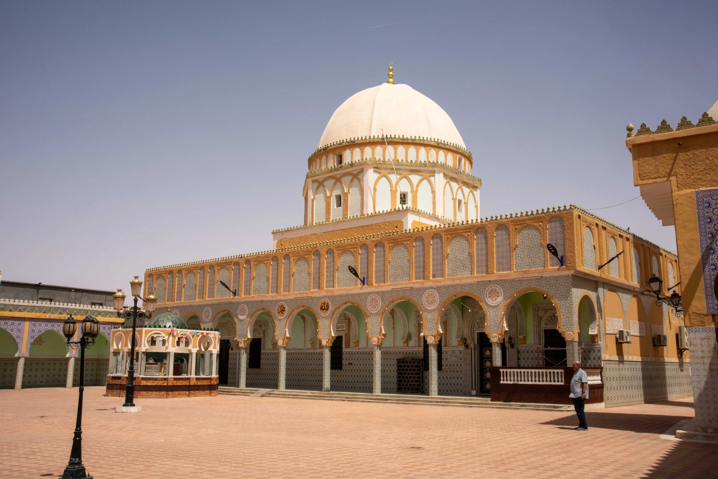
This shrine is in the form of a mosque known as the Tomb of Sidi Tidjani Zaouia. It is an ornately decorated mosque built in the 12th century and is considered one of the finest examples of Almohad architecture in North Africa. It has a large central dome and four smaller domes surrounding it.

Shrine of Tidjani Zaouia, Timoussine

Mosque, Shrine of Tidjani Zaouia, Timoussine

Sidi Tidjani Zaouia was acknowledged by his followers as a Sufi Saint (Sidi means saint) and as such, this caused a rift within the Islamic religion which does not follow the Christian custom of declaring sainthood.

Sidi Tidjani seems to have behaved more like an Indian Guru by establishing a distinct ‘brotherhood’ where Islam was supplemented by meditation and other mystic pursuits. The Sufi Tidjani was held with such reverence that apparently his feet were not allowed to touch the ground and consequently he was transported around in a totally enclosed ‘sedan chair’ type of carriage.

Sufi Tidjani's carriage, Shrine of Tidjani Zaouia, Timoussine

Tidjani is buried in the mausoleum section of the mosque surrounded by the graves of his disciples. The central golden tomb is enclosed directly under the main dome and a spectacular chandelier.

Dome and chandelier inside mosque, Shrine of Tidjani Zaouia, Timoussine

Tomb of Sufi Tidjani in Mausoleum, Shrine of Tidjani Zaouia, Timoussine

The prayer hall of the mosque was open and although we didn’t enter, we could see through the door the ornate decorations of carved marble, stucco and ceramic tile work.

Prayer Hall of Mosque, Shrine of Tidjani Zaouia, Timoussine,

This mosque and shrine are considered significant cultural and historical symbols of Tlmoussine’s rich heritage and form an important place of worship for Muslims.

In some oases, farmers use fire to destroy insect pests on the lower trunk sections of the date palms. Normally this only burns the bottom two metres or so and does no damage to the palm. We passed one palm oasis where the fire must have got out of control and the damage to hundreds of date palms was devastating with many killed.

Burnt date palms, between Timoussine & Ouargla

As we approached Ouargla we became aware that the now incredibly barren and utterly inhospitable landscape was rich in crude oil as evident by pipelines across the sand.

Oil pipeline near Ouargla

Petroleum was discovered here in 1952 and Ridwane suggested that the reserves may be even greater than those of the Persian Gulf. Algeria is clever in not releasing the ‘black gold’ too rapidly as this obviously affects the price and Algeria’s comparative wealth is largely dictated by the world’s demand and the crude oil price.

At Ouargla we had light lunch in a restaurant at a table labelled ‘VIP’!

Lunch at Ouargla

We left Ouargla at 14:00 with the temperature at a warm and dry 36°C and passed the Ouargla University’s impressive buildings. We were delighted to hear that this university specialises in mathematics.

After nearly 500 km of travel for the day we arrived at our ‘Farm Stay’ destination and congratulated our driver on his amazing efforts.

Our accommodation is on a small hill overlooking the farm’s oasis growing dates, olives, fruits and fodder crops for sheep and cattle. All the water for the farm and animals comes from a well 200 m deep!

Corinne outside our room at the Farm Stay, near Ghardaia

Date palms and crops at Farm Stay, near Ghardaia

Our farm is along a short driveway from highway N1 which connects Algiers with Mali and Niger.

For our evening meal we had Bedouin style seating arrangements with traditional Saharan foods served practically at floor level. The meal comprised a green salad followed by vegetable soup, spring rolls and meat balls in a herb and spicy sauce. Dessert in the desert was melon pieces and a mixture of honey soaked dried fruits.

Dining area, Farm Stay, near Ghardaia

The tea ceremony that followed was one where tea was poured from a tea-pot, falling down into a glass jar, a metre below. This was done three or four times to produce a thick froth which we were told was to act as a filter, preventing the wind blown Saharan sand from getting into the liquid tea beneath the froth. The tea tasted particularly strong but nonetheless pleasant.

Tea ceremony, Farm Stay, near Ghardaia

We then sat and chatted to our hosts and listened to some delightfully haunting Saharan music before preparing for bed.

Tomorrow we spend time visiting Ghardaia.

DAY 33: Sunday June 2nd 2024 GHARDAIA, ALGERIA

Although the nearest major town to our Farmstay accommodation is Ghardaia, we are actually 50 km south of Ghardaia on the N1 highway.

During breakfast we chatted with one of the farm management team and he informed us that, apart from horses and poultry, they have a dairy herd of around 350 cows but are only milking 55 at the present time. The milk is transported in a tanker to Ghardaia where it’s used principally in cheese and yoghurt production.

Because we knew the afternoon’s temperature would be 40°C or more, we decided to make and early start and head into Ghardaia immediately after breakfast.

Ghardaia is in the M’Zab valley and comprises five main traditional towns (or districts) and is home to the Mozabite people who follow different traditions and customs from the rest of Algeria and are extraordinarily isolated and conservative.

The first neighbourhood we visited was the 11th century City of Ateuf, one of the UNESCO sites. We had a rather overbearing and exceptionally noisy local guide who led us through old and uninspiring alleyways to a high point where the city’s main mosque was located. The minaret, as do all others in Ghardaia had a distinct shape being a tapered square section tower made from stone and rendered with an orange/brown bubble coating which supposedly helps keep things cooler.

Our guide Radwine with the local guide Abraham, Ateuf

Graveyard and minaret, Ateuf

We then wandered down steps past a stony graveyard to arrive at a modest, single storey white mosque. It had three arched openings and no doors, loudspeakers or minarets.

It was built in the 15th century and now is a UNESCO historical site.

White mosque from graveyard, Ateuf

There were enclaves for candles and one that pointed to Mecca. There was a recessed section where an Imam could offer prayers although men and women gathered in different parts of this tiny mosque.

Enclave pointing to Mecca, mosque, Ateuf

Inside mosque, Ateuf

Our visit to Ateuf was quite underwhelming with the district being quite drab and dirty. The people in Ghardaia are known to be incredibly conservative and in Ateuf it was hard to get people to say hello or acknowledge our greetings. The married women are totally wrapped in white robes with there being just a tiny space for one eye to look through. Any greeting we offered to them resulted in an immediate turn away from us and certainly no response.

We passed by the city of Eliqua and then moved on to the next main neighbourhood of Ghardaia called Beni-Isguen. Here we spent time visiting the main market square and associated alleyway souks.

The people in Beni-Isguen were much friendlier than those in Ateuf and we had a pleasant hour wandering through clothing, shoe, carpet, jewellery and food markets.

The food alley was the most interesting with lots of vegetables and fruits on sale including some types unknown to us. The range of spices and olives were especially colourful for photographing and the market salespeople (all men) were happy to have photos taken.

Men asking for their photo to be taken, Market Place of Ghardala Ksar, M'Zab Valley

Olives, Market Place of Ghardaia Ksar, M'Zab Valley

In amongst the food stalls was a butcher’s shop and the owner summonsed us to photograph the camel they had butchered. He proudly presented the camel’s head to us and laughed at our reactions at seeing this grotesque severed head.  

Butcher with camel head, Market Place of Ghardaia Ksar, M'Zab Valley

Nearby we saw a giant version of a rabbit trap and asked what it was for. The best answer was that it was for trapping hyaenas as these animals play havoc with local sheep and goat herds.

Hyaena trap, Market Place of Ghardaia Ksar, M'Zab Valley

Men wearing traditional pantaloons, Market Place of Ghardaia Ksar, M'Zab Valley

With the temperature approaching 40°C, we took time out to have cold, freshly squeezed orange drinks and a banana.

We next drove to a high point of a neighbourhood of Ghardaia called Boundora.

Veiled women, M'Zab Valley

The view was impressive but affected by the atmospheric dust now appearing over the city as the wind had picked up and the temperature was soaring.

View from Boundora, Ghardaia

Tapered minaret, Boundora, Ghardaia

Watch Tower on old city wall, Boundora, M'Zab Valley

City Wall, Ghardaia, M'Zab Valley

We decided we’d experienced enough and started our journey back to our Farm Stay home. A fleeting stop at a lookout point on the outward main road enabled us to observe the preponderance of blue and white homes in Ghardaia especially in the Melika section of the city.

Our van at City Wall, Ghardaia, M'Zab Valley

On the way home we also stopped to get diesel fuel for the van. Just for interest sake we recorded the prices per litre and were staggered to see how cheap it was.

View from lookout point, Ghardaia, M'Zab Valley

Diesel is 33 cents a litre, unleaded is 51 cents a litre and LPG is 9 cents a litre. (note: prices converted to Aussie dollars!).

Men with portable fire extinguishers at petrol station, M'Zab Valley

Local man at petrol station, M'Zab Valley

Thus it’s not surprising to see that despite Algeria being amongst the group of ‘rich’ African countries, we have not seen any electric cars since our arrival a week ago. Algeria, we are told has no intention of reducing its reliance on fossil fuels while their reserves are so plentiful and the costs are so low.

Men at gate at Farm Stay, near Ghardaia

Farm Stay, near Ghardaia

Jak, Corinne, Diana and Chris at dinner, Farm Stay, near Ghardaia

DAY 34: Monday June 3rd 2024 GHARDAIA – EL GOLEA - TIMIMOUN, ALGERIA

Before breakfast time at our Farm Stay accommodation, Corinne spent some time inspecting the animal life in the farmyard pens. Amongst the wildlife were ostriches, Guinea fowl, camels, horses and domestic hens. The 350 dairy cows were further afield and not seen.

Horse, Farm Stay

Camels, Farm Stay

Guinea fowl, Farm Stay

Chickens, Farm Stay

We then commenced our 600 km road journey to Timimoun with the Sahara on either side of this very busy North African transport highway. After an hour we stopped for coffee and an opportunity for Adlene, our driver to have a refreshing drink and a cigarette. The petrol station/café we stopped at was a popular resting point for transport drivers as indicated by the car park being packed out with trucks of every imaginable size.

Our morning tea stop with the truck drivers, en route from Ghardaia to Timimoun

The barren and desolate Sahara occasionally throws up surprises such as a lone stunted tree in the middle of nowhere or a small stony flat-top mesa in an otherwise level desert. But it was equally surprising to suddenly come across a number of 300 m radius, rotary irrigation booms watering green pastures or grain crops. Inevitably, there were the occasional clusters of camels eating the sparse and dusty vegetation along the roadside.

Irrigation boom, en route from Ghardaia to Timimoun (haze is sand storm)

Rocky hill en route from Ghardaia to Timimoun, (haze is sand storm)

Mesa & hill en route from Ghardaia to Timimoun

Lone tree, highway between El Meniaa & Timimoun

Another disturbing issue is the sight of illegal refugees from Niger and Mali walking/hitch-hiking up the N1 hoping to reach Algiers and to get a boat ride to Italy. The only beggars we saw in the Ghardaia market square yesterday were women from Niger.

After the first 200 km on this main north/south highway we made a stop at El Golea (or El Meniaa) and visited the National Public Museum of El Meniaa.

Street in El Meniaa en route to Timimoun

In 1958 Father Ronnie Le Clerk, a Catholic priest teaching in a local school began collecting geological specimens and antiquities of all kinds from within the local area. This important and originally school based geological end ethnological collection has, since Le Clerk’s death, been converted into a museum in recognition of Father Le Clerk’s extraordinary efforts in searching for and classifying the enormous number of exhibits.

For us it was pleasing that most specimens were labelled in English as well as Arabic. The items are displayed in an appealing fashion using excellent lighting and with attached detailed descriptions of their origins and points of interest.

Exhibits that particularly caught our interest included the fossilised skeletons of an eel-like Hypodus fish and an exquisite and tiny Hippocampus sea-horse. There was much to intrigue those of us with a paleontological interest and of particular note were the fossilised 150 million year old vertebrae of a Diplodocus from the Jurassic period.

Fossilised skeletons of an eel-like Hypodus fish, National Public Museum of El Meniaa

Hippocampus sea-horse, National Public Museum of El Meniaa

Diplodocus, National Public Museum of El Meniaa

There were many items on display from early Neolithic times through to more recent human occupation of this North African region. Stone tools and arrow-heads of various shapes and sizes were impressive.

One particular exhibit that caused great interest was a large (~50 kg) white sandstone rock labelled ‘Pierre de ben baror’. The rock had a very well worn or eroded waistline and we were all intrigued to know what this was all about, as the only information available was not in English.

‘Pierre de ben baror’ rock, National Public Museum of El Meniaa, El Meniaa

We were told that the story of this rock involves part truth and certainly a good deal of myth. Apparently, a camel owner in the very, very distant past had his camel drag this rock by a rope across the desert from El Meniaa to Niger (1000 km away) to mark out (or plough?) a trail for traders from southern lands to follow and find the caravanserais along the way. The camel must have reacted badly to this excessive workload we’re told, as it eventually killed its owner.

After the museum we visited the Catholic Church of Father Charles de Foucauld in El Meniaa.

Catholic Church of Father Charles de Foucauld, El Meniaa

Inside Catholic Church of Father Charles de Foucauld, El Meniaa

Charles de Foucauld was a French soldier, explorer, geographer, ethnographer, Catholic priest and hermit who lived among the Tuareg people in the Algerian Sahara.

His inspiration, writings and evangelical work with the desert Berber people led to the founding of various religious communities including the Little Brothers of Jesus. He was accused by the French government of being a spy and assassinated by beheading in 1916 at the age of 58. His remains are in the graveyard adjacent to the Church. After nearly one hundred years of wrangling, Charles de Foucauld was eventually canonised as a saint by Pope Francis in May 2022.

Tomb, Catholic Church of Father Charles de Foucauld, El Meniaa

Graveyard, Catholic Church of Father Charles de Foucauld, El Meniaa

Our next stop was at the base of a small but prominent limestone hill where on top are the remains of the Fortress (Ksar) of El Meniaa.

Fortress (Ksar) of El Meniaa, El Meniaa

This fortified hilltop village was built in the 10th century AD by the Zenata people, an Amazigh tribe and one of the largest Berber confederations. This fortress was attacked and partly destroyed by the French invaders in the 17th century. It has been unoccupied for the centuries since that time and is progressively turning into rubble.

After a quick perusal of some tourist souvenirs in an expensive shop, we had a late lunchtime bowl of soup and then continued southwest through the rolling dunes and lunar landscape of the Sahara. We arrived at the ‘Red City’ of Timimoun at around 17:30 after a monumental driving effort of 600 km by wonderful chauffeur Adlene.

Trucks on the highway between El Meniaa & Timimoun (haze is sand storm)

Occasional sign showing a bend in the road, highway between El Meniaa & Timimoun, (haze is sand storm)

We have accommodation for the next two nights at the hotel Dar el Yamama and we are the only guests. The management is about to close the hotel until mid-September because the weather becomes unbearably hot with temperatures even exceeding 50°C. When we arrived at 18:30 the air temperature was 36°C.

DAY 35: Tuesday June 4th 2024 TIMIMOUN & SURROUNDS, ALGERIA

Timimoun is in the Adrar Province of the south-central Algerian Sahara. It is often referred to as the ‘Red Oasis’ due to its buildings, many of which are made from red-mud bricks often with sticks poking out of them; a building technique described as the ‘Sudanese’ style of architecture.

With a population of around forty thousand, Timimoun originally relied on tourism and agricultural activities in the nearby oasis for employment opportunities. This has changed significantly in recent years because of the major oil and gas developments occurring in the Adrar province.

For our introduction to Timimoun’s tourism prominence, we drove to the nearby village of Ighzer to view the ruins of the Ksar of Ighzer.

Before visiting the ksar (castle/fortress) we entered a cave that exists directly under the old castle. With the nearby salt-lake plains there’s a possibility that the ksar was originally close to water and that the cave may have been underwater.

Cave, Ighzer

Cave, Ighzer

Jak inside Cave, Ighzer

This 5th century castle is now in ruins and the red mud-brick rooms are progressively filling with sand blowing off the Saharan dunes all around.

Ksar (castle-fortress), Ighzer

Ksar (castle-fortress), Ighzer

Doorway filling up with sand, Ksar (castle-fortress), Ighzer

We wandered through the narrow streets and alleys and climbed to a high point where a panoramic view was possible despite the dusty atmosphere caused by the famous Saharan sirocco.

Ksar (castle-fortress), Ighzer

Shrine & view from the top, Ksar (castle-fortress), Ighzer

We then drove a short distance to view and learn about the Algerian foggara irrigation system.

This entails a network of underground waterways designed to combat the aridity of the Sahara. Originally developed in Persia (Iran), the irrigation concept was brought back to Algeria by Muslims who had visited Mecca and Persia in the 10th century AD.

Foggara irrigation system

Foggara irrigation system

Deep wells, often to 10 m below ground level were dug to reach artesian water which was then diverted into main underground channels which in turn, divided further to supply gardens and families according to their water demand. This gently sloping gallery of drains was up to 15 km in length and although small in diameter, the space was large enough to accommodate a stooped worker, ‘the water measurer’ who was in charge of maintaining the foggara and drilling holes to direct the water to users.

Wells coming from the desert, Foggara irrigation system

Wells leading to the village, Foggara irrigation system

With the whole system being effectively underground, loss of water by evaporation in the intense Saharan heat was largely avoided. The water supply system is still in operation nowadays although some of the underground channels are now made from PVC and we presume electric pumps have now replaced the ‘water measurer’.

To learn about an alternative style of ksar construction, we drove to Aghlad (or Oulad) to view a number of castles built in the 5th/6th century using grey mudstone clay rather than the more common orange/red clay which dominates the scene with Timimoun’s buildings. The deserted castle we visited was presumably originally occupied by pagan Berbers who then converted to Islam after the arrival of Muslims to the region in the 7th century. We could see the remains of a mosque that had been built outside the walls of the ksar suggesting it was a later addition.

Castle remains, Aghlad village

Mihrab (semicircle where Iman stands for prayer & direction to the kaaba, castle remains, Aghlad village

Castle remains, Aghlad village

Castle remains, Aghlad village

View from castle remains, Aghlad village

The intense heat was obviously felt by a power line worker on the road from Aghlad village to Timimoun who beckoned to us to give him some water.

Man doing maintenance on power pole (he asked us for water), near Aghlad village

On our return to Timimoun city we visited ‘Capterre’ which is the Algerian Centre for the Conservation of Earthen Architecture. Its aim since its establishment in 2012 is to develop strategies for the rehabilitation of mud-brick buildings in Algeria.

Capterre is housed in a former 1920s hotel that has now been converted into general offices and the technical college for students to learn the art and skills of mud brick making and rehabilitation.

Former hotel, now Centre for the Conservation of Earthen Architecture - Capterre, Timimoun

Stucco clay bricks, Centre for the Conservation of Earthen Architecture - Capterre, Timimoun

The hotel has interesting clay patterns on the walls and one of the rooms shows a plaque indicating that the Duchess of Luxembourg stayed there during a Citroen car rally through Algeria in 1926.

Plaque, Rooms occupied by Grand Duchess of Luxembourg, Capterre, Museum

A quick perusal of the local market area followed and then we took photos of the Sudan Gate which was at some point, part of the main city wall. The term sudan does not relate to the country but more correctly it’s a term used to describe black African people.

Sheep outside local market, Timimoun

We returned to our hotel at 13:00 with the temperature in the mid 30s.

View from rooftop of our hotel (Dar Yamama), Timimoun

We had a pleasant lunch break and then had free time until a safari 4x4 tour to see the sunset after 18:00.

In two separate 4x4 cars with no seatbelts, we ventured northwards towards a small village and then followed a sandy track to a point where we stopped and looked for fossils on a stony section of track. There were lots of marine fossils including bivalves, gastropods and some conical invertebrates that may have been ascidians.

Looking for fossils on sand dunes, Timimoun

Fossils on sand dunes, Timimoun

Fossils on sand dunes, Timimoun

We followed the track along the base of a high dune range and then stopped to watch the sunset at a location not far from Ouled Said. To get a better view we clambered up the steep dune slope and then sat and waited. The sunset was disappointing to say the least, with the level of sand dust at horizon level effectively blocking out everything except the pale-yellow ball of the sun. Thankfully the wind had now dropped and conditions were much more pleasant in the cooler evening air.

Corinne & Jak watching the sun set from the sand dunes, Timimoun

Watching the sun set from the sand dunes, Timimoun

Watching the sun set from the sand dunes, Timimoun

Watching the sun set from the sand dunes, Timimoun

The drivers had meanwhile lit a small fire on the sand and boiled water to make tea. This was done in the traditional way of ‘high-pouring’ several times and then adding sugar to quell the bitterness of the very strong brew of tea they had prepared.

Our local guide preparing tea on the sand dunes, Timimoun

Preparing tea on the sand dunes, Timimoun

We drove back to Dar el Yamama and had an excellent evening meal under the stars which struggle to shine through the Sahara’s upper atmospheric dust.

Tomorrow, we begin the final phase of this African odyssey. We fly from the Sahara up to Oran on the Mediterranean coast where we have two days before heading home to Australia.

One point of sadness is that tomorrow we have to part company with our driver Adlene, who despite not speaking much English has become a good friend and much admired companion for the last ten days.

DAY 36: Wednesday June 5th 2024 TIMIMOUN - ORAN, ALGERIA

Our van is having a mechanical service this morning which will include a grease and oil change plus air-cleaner filter replacement. This is particularly important as this Saharan dust gets into everything, including car engines. Tomorrow Adlene will be driving the van alone back to Algiers while Ridwane accompanies us on to Oran.

We had a leisurely breakfast and then had the morning, until 11:00 as free time to prepare for our flight to Oran and our further travel homewards.

At 11:30 we said farewell to the charming husband and wife owners of Dar el Yamama and complimented them on the superb meals that they’d served us during our stay.

Adlene, for our last trip with him, drove us to the Timimoun airport some 10 km away. There were emotional moments for all of us and we could see tears welling in Adlene’s eyes. It was hard to say goodbye when he’d looked after us so well and been such an amazingly careful and capable driver. Whether it was in the chaos of big city traffic jams or out on the open highways coping with hundreds of fast moving trucks, Adlene showed remarkable skills and patience.

Saying farewell to Adlene, Timimoun

Our flight to Oran was supposed to be leaving at 14:00 but on arrival at the airport we were informed that the flight was likely to be two hours later than scheduled.

We waited patiently with the additional concern that the pilots have the option of not flying down to Timimoun if there’s the possibility of the Saharan winds causing sand storms and subsequently low visibility for landing. However, eventually the Air Algerie ATR 72-500 plane did turn up.

Before boarding the plane, we had to identify our bags and see that they were placed on the trolley for loading. This identification of luggage took place on the tarmac in 42°C heat and then on boarding we found the temperature in the plane was not much less. Although seat allocation was shown on our boarding passes, no-one took any notice and sat wherever they wanted.

Our flight took off at 16:15 and by the time we’d climbed for only a minute or so, the ground was barely visible due to the air being so full of red Saharan dust.

The day’s intense heat had caused atmospheric disturbances making the first thirty minutes of flying quite bumpy.

The flight lasted just on two hours and covered a distance of about 700 km. For the last half hour, the view out the window changed and we could now see farms and green crops as opposed to the orange monochrome of the Sahara desert.

Our Air Algerie plane from Timimoun to Oran

Oran airport was clean and the baggage handling done promptly and efficiently. Ridwane introduced us to our new driver (just for tomorrow) and he drove us to our Le Palme hotel in central Oran. The outside temperature was about 25°C and so much more comfortable than the oppressive heat of the Sahara.

We showered and had a buffet style evening meal in the hotel’s dining room after a day involving a lot of waiting and not much physical activity.

Our visit to the Sahara for these last few days has been eye-opening with a great deal to see of historical, archeological and cultural significance. The very hot, dusty and super dry weather has made our visit to the Sahara quite demanding although we must acknowledge that it was our decision to arrive in this extraordinary and fascinating part of the world in the summer season!

Tomorrow we spend our last full day in North Africa visiting sights of interest in and around Oran.

DAY 37: Thursday June 6th 2024 ORAN, ALGERIA

Oran is the second largest city in Algeria and is located in the north-west of the country on the Mediterranean coast. The major importance of Oran to Algeria is largely due to its commercial and industrial operations in the vicinity. In addition, the deep water harbour provides a close and very convenient contact point to both Spain and France for purposes of trade and tourism.

Oran has a population of just under two million and has its name derived from the Berber words meaning ‘place of lions’. In the period around 900 AD there were sightings of the long maned Barbary lions in the area.

The history of the area is complex although it is thought that Oran was founded in 903 AD by Berber tribes.

The Spanish captured the city in 1509 and held sovereignty spasmodically until 1792 and then Algerian troops with the assistance of the Ottomans took control. This lasted until 1831 when the city fell to the French invaders and then the French held control until 1962 when the Algerians finally defeated the French after a long and deadly war of independence.

As might be expected, this delightful Mediterranean city has numerous examples of architecture showing both strong French and Spanish influence.

Our first tourist visit for the morning was to the Oran Bullring. This is the only arena for bull-fighting in Algeria and it was built by Spanish settlers in 1905 and opened its doors to corrida (Spanish for bull-fighting) in 1910. The arena could hold a maximum of thirteen thousand spectators and corrida occurred on Sundays when typically six bulls were to face the matadors.

Oran Bullring

Although corrida no longer occurs, the magnificent arena is used for other activities such as wrestling and community gatherings. Apparently it can’t be used for music festivals and rock concerts because there’s a mosque nearby and people would complain! Under the grandstand seats are 145 pillars and the spaces between them are used for craftwork and art displays.

Oran Bullring - inside

Oran Bullring - inside

We spent nearly an hour at the arena and had a very pleasant guide called Nora who gave us a comprehensive coverage of the arena’s history.

We then visited the Oran Museum which specialised in natural history. The museum was established in 1891 and has a vast collection of rocks, coins, fossils, insects, shells, fish and birds. Unfortunately the collection appears to have been neglected for many years and many of the animal specimens have deteriorated to the point that they are worthless. This problem has come about by the fact that most specimens have been exposed to natural light and subsequently colours and fine details have disappeared. The fossil collection had not suffered this demise and was most impressive.

A small part of the butterfly & insect collection, Oran Museum

One exhibit that caught our attention was a large lead anchor from the Roman era.

Large lead anchor from Roman period, Oran Museum

The old Oran Railway station which opened in 1913 was our next location visited. The station was designed by French architect Albert Ballu with a modern Moorish style externally and an internal architecture and decor showing the influence of Islam, Judaism and Christianity. We had a most entertaining time chatting with the Station Master who then allowed us to enter a restricted area to take photographs.

The old Oran Railway Station

Inside the old Oran Railway Station

Station Master, The old Oran Railway Station

The old Oran Railway Station

We crossed the road to see the new railway station but there was little of interest in this modern building.

The former Oran Cathedral has been converted into the now named Ben Aouda Municipal Library, but being a ‘library’ is not really its main function. On dusty, ancient shelves there is a jumble of books distributed in seemingly random order around the perimeter of the old cathedral. In the middle of the building are dozens of tables and chairs where school and university students are able to study and work quietly. Students mostly were working in small groups and some appeared to be having specific tutorial assistance. We chatted with some who were facing their Baccalaureate exams for maths and physics in nine days time. We offered them ‘best of luck’!

Ben Aouda Municipal Library

Inside Ben Aouda Municipal Library

Jak talking to students, Ben Aouda Municipal Library

Jak found an English chemistry book, Ben Aouda Municipal Library

We wandered through a market section and saw the usual fruits, vegetables, spices and meats on sale but in an isolated section was a man selling live snails. He had facilities for cooking them and was very keen for us to try his escargots.

Despite his insistence, we declined his offer.

Fish stall in market, Oran

Snails in market, Oran

After leaving the market area we came upon a main square around which were located the Theatre, Town Hall and Post Office buildings. All three were impressive structures, especially the theatre with its Spanish columns, central capital statues and attractive green tiling directly below ‘Comedie, Opera and Tragedie’.

Post Office, Oran

Town Hall, Oran

Bronze lion on Town Hall steps, Oran

Theatre, Oran

The Town Hall is in the process of being refurbished but nonetheless the external architectural features are grand. On either side of the front steps are two large bronze lions, these being Barbary lions from which Oran got its name.

After some delicious creponne icecream (lemon cream sorbet?) we strolled along the high road above the waterfront and looked at the bustling activity in the harbour below. A high density of ferries, cargo ships and pleasure craft were all protected from the open Mediterranean being inside a very long concrete groyne.

Harbour, Oran

Santa Cruz Fortress from the harbour, Oran

For the conclusion of our final day’s sight seeing, Aziz drove us up towards the Santa Cruz Fortress which is strategically placed at the top of l’Aidour Mountain, more than 400 m above sea-level. This fortress, built between 1577 and 1604 was where the Spanish Governor of the time has his headquarters, protected within 2.5 km of surrounding, thick and continuous walls.

The Fortress, Oran

We could not enter the fortress but on the same mountain, just below the fort was the small chapel of Notre-Dame of Santa Cruz. This chapel has recently been refurbished with an attractive tower now having a huge statue of the Virgin Mary on top. We spent some time at this chapel principally because it provided a spectacular lookout point enabling us to have a glorious panoramic view of Oran city and harbour below.

Tower with statue of the Virgin Mary, Notre-Dame of Santa Cruz, Oran

Inside the chapel, Notre-Dame of Santa Cruz, Oran

Statue of Virgin Mary, Notre-Dame of Santa Cruz, Oran


Notre-Dame of Santa Cruz, Oran

Oran viewed from Notre-Dame of Santa Cruz, Oran

Ben Aouda Municipal Library viewed from Notre-Dame of Santa Cruz, Oran

We returned to our hotel Le Palme via the very oldest part of Oran city which, through age and neglect has most of its buildings unoccupied and crumbling into heaps of rubble. New homes will eventually replace these derelict structures.

Tomorrow we have an early start with an 08:00 flight from Oran to Algiers and then the commencement of our long flight home via Doha.

DAYS 38 – 40: Friday 7th June, ORAN, ALGERIA – Sunday 9th June 2024, HOBART, TASMANIA, AUSTRALIA

With there being practically no traffic on the roads at 06:00, we were at the airport within half an hour of leaving our Oran hotel. We thanked Aziz who had been our driver for these last two days and checked in to find that our flight to Algiers would be delayed by around two hours.

We waited patiently and eventually our Air Algerie ATR 72-600 arrived and we were on our way to Algiers, a flight taking about an hour and a quarter.

Our plane from Oran on arrival in Algiers

At Algiers we said farewell to Ridwane who had been a most informative and congenial guide for our past ten days.

Thankfully, at Algiers our bags were checked in right through to Melbourne. We then had a four hour wait in Algiers where we bought drinks, read, slept and spent the very last of our Algerian dinars on an Algerian cap which was much too expensive but we didn’t really mind.

The flight to Doha was in a Qatar Airways Airbus A300 and took just on six hours and with the time zone difference it meant we landed in Doha at just before midnight on Friday 7th June. The touchdown was so smooth we weren’t really sure that we’d even landed until we heard the engine braking noise. 

Our plane from Algiers to Doha, Algiers

The Doha to Melbourne flight was in a Qatar Airways Boeing 777 and was on time leaving Doha at 01:35, on a very early Saturday morning.

Our first alcohol for 3 weeks! On the plane from Algiers to Doha

Our first alcohol for 3 weeks! On the plane from Algiers to Doha

The overnight flight to Melbourne took just over 12 hours and covered a distance of almost 12,000 kilometres and had us arriving at Tullamarine at 22:50 Saturday night.

Our flight path from Doha to Melbourne

Diana and Chris then had a lengthy ‘transit’ delay before their Qatar flight continued taking them on to Adelaide. At this point we had to say goodbye to our dear friends and travelling companions for this last month. It was sad to say farewell after all the fun and experiences we’d enjoyed together in Tunisia and Algeria.

North Africa map showing places we took photos, May-June 2024

We gained consolation in knowing that we’ll all catch up again sometime soon, whether it be in South Australia, Tasmania or on another overseas adventure.

We did some duty-free shopping, passed through customs and caught a shuttle-bus to the nearby Holiday Inn hotel, arriving at 00:15 Sunday morning, June 9th.

Although it was a fairly short sleep period, the six hours was enough to revive the spirits and have us ready to head for Hobart at 08:40.

All went exactly to plan and our wonderful next-door neighbour, Kelly was at Hobart airport to collect us and bring us home. This travel sequence from Oran to Hobart meant we’d been on the move, either in the air or waiting in airport terminals for over 30 hours. 

 These six weeks of travel, adventure and discovery in North Africa have been far more exciting and enjoyable than we had ever expected. The experiences, sights, scenery, history we’ve learnt and friends we’ve made have been absolutely fantastic.

We have been so fortunate to have had such wonderful guides, who without exception have been so knowledgeable and enthusiastic about showing us their countries. Our drivers too have been exceptionally safety conscious and so courteous and helpful, we could not have asked for anything better.

Special thanks to Jean at Travelbookers and Chelsea and Jim at Native Eye for their valued assistance in putting the whole itinerary together and ensuring it all worked perfectly.

Finally, our gratitude goes to Diana and Chris who provided, as always great company and friendship throughout this adventure together.

During the six weeks of travel time in North Africa we have been acutely conscious of the fact that our very close and loving friends Sinclair and Janet have not been able to travel with us as planned. Our thoughts and concerns were with them both throughout our six weeks journey and we hope that sometime in the future we will be able to resume our travel adventures with them again.