As the road up to Horton Plains National Park is quite narrow and has a number of tight switchback turns our Toyota ‘Coaster’ bus was deemed unsuitable and hence two smaller buses were organised for the trip.
We left our hotel just on 05:30 and headed southwards in the pre-dawn light for about an hour. The first section took us through the outskirts of Nuwara Eliya where we could see numerous small market gardens and then with the rising sun we entered an area which is the region’s dairying centre. There were a number of large dairy herds grazing on lush pastures. The cows seemed to be mostly a guernsey cross and all looked very healthy. A milk processing factory was close by.
Dairy herd
The road then started to climb and we entered an extensive area of eucalypt forest. At one particular high crest in the road we crossed the railway line at Pattipola Station which is the highest station in Sri Lanka.
The road then became much narrower and significantly steeper with some very tight corners. Thank heavens our drivers were meticulously cautious because any misjudgement could easily have resulted in the vehicle plunging over the unguarded edge.
At an elevation of just over 2000 m we entered the Horton Plains National Park which has a remarkable similarity with the Scottish Highlands with its windswept landscape and misty surroundings. A herd of Sambhur deer was sighted close to the road further enhancing the impression of Scotland.
Sambhur deer, Horton Plains
The park is named after Sir Robert Wilmot-Horton, the British governor of Ceylon from 1831 to 1837. It was formerly a wildlife sanctuary and then declared a national park in 1988, its area being 3160 hectares.
This plateau is the highest in Sri Lanka with a terrain that is characterised by undulating grasslands, meandering streams, rocky outcrops, waterfalls and dense montane (cloud) forests. The scenery offers a close similarity to parts of Tasmania’s highlands with the small tarns, button-grass plains and misty forests.
Rhododendron, Nature Trail, Horton Plains
Rhododendron flower, Nature Trail, Horton Plains
Stream with rhododendron on the bank, Nature Trail, Horton Plains
Hypericum perforatum, Nature trail, Horton Plains
Aristea ecklonii,, Nature Trail, Horton Plains
Princess flower (Tibouchina urvilleana), Nature Trail, Horton Plains
Amongst the native flora seen, the rhododendrons were the most unexpected and the most colourful with the hillsides near the car park being dotted with many thousands of these red flowering shrubs. The park is also a popular bird-watching location and we saw several unidentified birds plus some whistling thrush and yellow-eared bulbuls.
Our drivers, Horton Plains
ohn, Janet, SInclair, Janet, Corinne & Jak at start of Bakers Fall & World's End circuit walk, Horton Plains
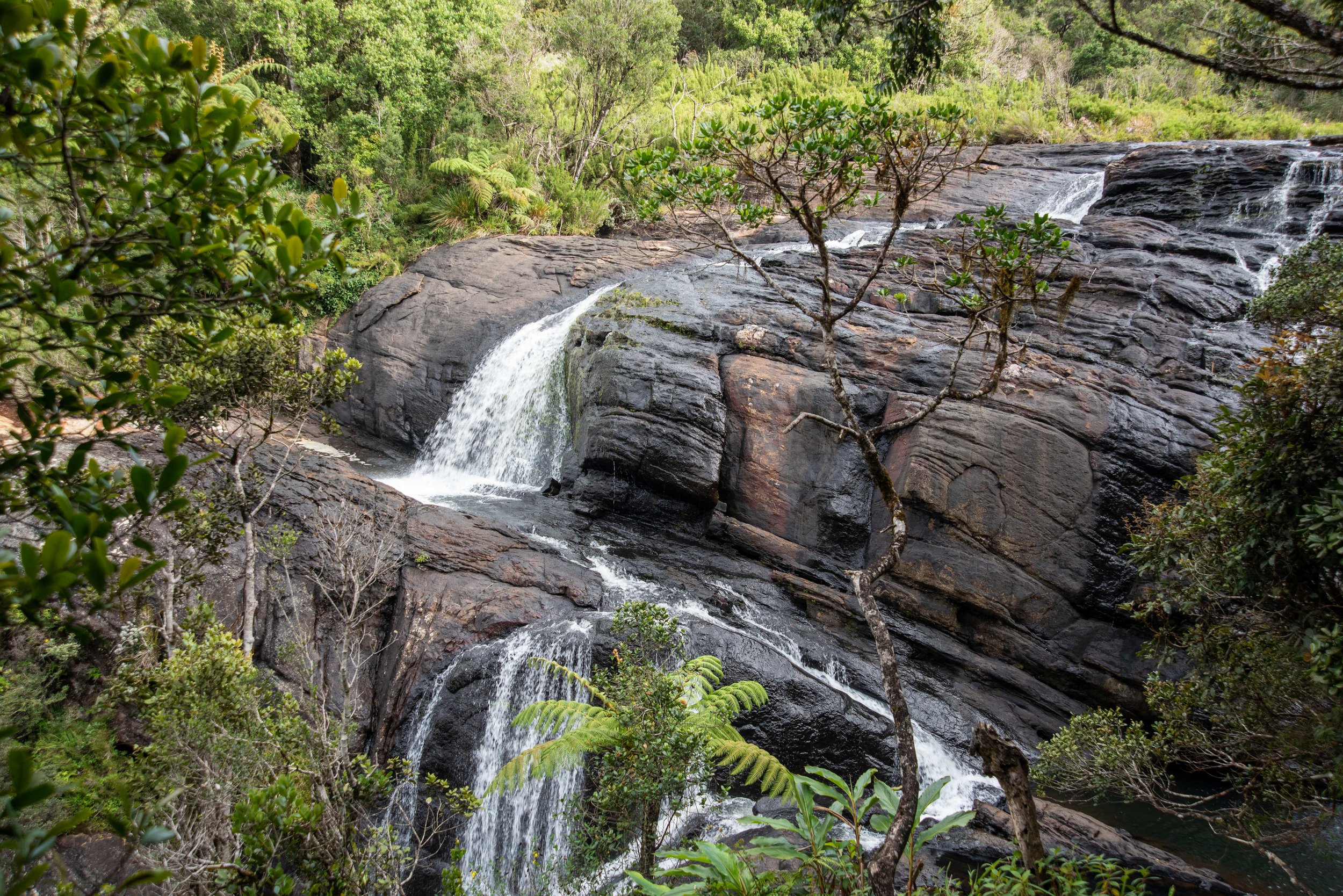
We followed the Loop Trail which covers a distance of about nine kilometres. Our first major stop was at Baker’s Falls. This 20 m high waterfall is reached by descending a steep concreted path through cloud forest to a viewing platform. As there hasn’t been a large amount of rainfall recently the cascade wasn’t dramatic but nonetheless it was beautiful in the early morning sunlight. The plateau receives monsoonal rain with an annual precipitation of over 5000 mm and the waterfall is at its best after heavy falls.
Baker's Falls, Nature Trail, Horton Plains
Group at Baker's Falls, Nature Trail, Horton Plains
Stream, Nature Trail, Horton Plains
Group on Nature Trail, Horton Plains
We then headed further south along the walking trail and within minutes the cloud dropped and we were in fog and light misty rain which meant that when we arrived at World’s End we could see no more than a few metres in front of us. The view we mist (pun intended) out on is an escarpment plunging 880 m into the lowlands below.
World's End, Nature Trail, Horton Plains
World's End, Nature Trail, Horton Plains
The drizzle then eased a little but for much of the remaining walk we were in mist as we wandered through cloud forest with its canopy dominated by the umbrella shaped keena trees.
Mist near World's End, Nature Trail, Horton Plains
Endemic rat, Nature Trail
Mist at Little World's End, Nature Trail, Horton Plains
As we neared the end of our walk we passed Little World’s End but it too was fogged out so we were unable to get any photos. Before heading back we finished our breakfast that the hotel had provided as a ‘take-away’ meal box for early morning travellers.
We returned to our mini-buses having spent about three and a half hours completing the loop. The second half of the walk was a little disappointing but it wasn’t the ‘end of the world’!
On the return journey our driver spotted a purple-faced langur in the eucalypts.
Purple-faced langur
We arrived back at our St. Andrew’s Hotel at around mid-day and showered and had a generally relaxing afternoon which included making contact with family back in Australia.


